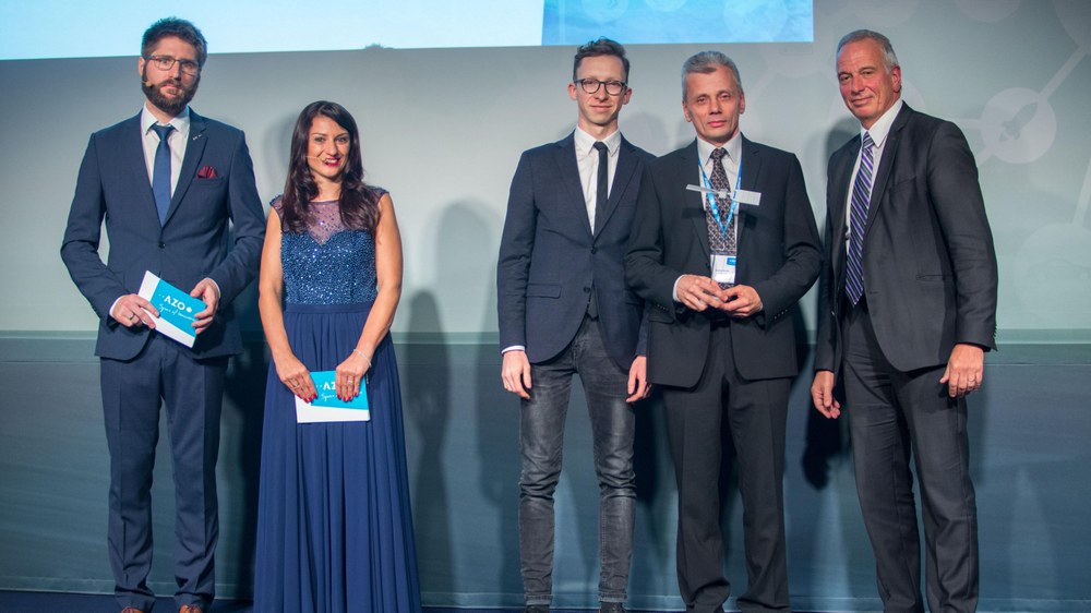
Innovative applications for Earth observation and satellite navigation win European competitions


- The 'European Satellite Navigation Competition' and 'Copernicus Masters' prizes are awarded in Tallinn, Estonia.
- The DLR Special Prize goes to two innovative projects in the fields of cyber security in aviation and fire detection on Earth using satellite data.
- Focus: space, aeronautics, security, cyber security, society, digitalisation
Cyber security and fire detection from space: these two ideas have won this year's Special Prize of the German Aerospace Center (Deutsches Zentrum für Luft- und Raumfahrt; DLR) as part of the 'European Satellite Navigation Competition (ESNC)' and the 'Copernicus Masters'. The competitions select ideas that demonstrate innovative uses for Earth observation and satellite navigation.
Cyber security in aviation
Digitalisation in aviation is not new. Digital innovations are of great importance for the future viability of aviation. Consequently, we must rethink our security strategies. This also includes cyber security. "Developing or adapting security models is an important decision," explains Pascale Ehrenfreund, Chair of the DLR Executive Board. "Digitalisation is a forward-looking step for aviation. The inherent potential ought to be exploited, while the risks should be recognised and hedged."
The DLR Special Prize of the European Satellite Navigation Competition goes to Lithuania. Saulius Rudys, a scientist at Vilnius University in Lithuania, has developed a system that enhances air traffic safety. The ADS-B (Automatic Dependent Surveillance-Broadcast) System is a common transponder technology, in which each aircraft transmits its GPS position alongside other information. The system is indispensable for air traffic control and the avoidance of collisions between aircraft. "However, such an important system is susceptible to attacks by hackers. Passenger safety would be at risk in such a case," emphasises Rudys.
In order to improve ADS-B security, he has developed methods and hardware for an additional authentication process. This also ensures safety in the event of a failure in global satellite navigation systems (GNSS) such as GPS. The new system works according to the principle of radio direction finding. It is fully compatible with the conventional ADS-B system. The slotted waveguide antenna system forms the main component, and avoids air drag. Because the modified system allows to determine the direction and distance to the aircraft, it can also work – albeit with reduced accuracy – in case of a failure in the GNSS signal. The system is resistant to spoofing (manipulation) and jamming (disruption).
Detecting fire from space
Remote sensing from space allows for the implementation of a number of applications. This is particularly fascinating when such applications can be used to save lives, and to ensure the safety of both people and the environment. "The rapid procurement, processing, analysis and release of satellite data in the event of natural and environmental disasters, for humanitarian aid activities and civil security on a worldwide scale is becoming increasingly important in times of global change," emphasises Ehrenfreund.
Gernot Rücker from the Munich company ZEBRIS has launched firemaps.net and won the DLR Copernicus Special Prize. The platform provides information on forest and bush fires by collecting data from various Earth observation satellites that monitor our planet from space.
Forest and bush fires account for approximately six percent of global greenhouse gas emissions. firemaps.net supports the managers of protected zones and decision makers on environmental policy by providing reliable, up-to-date and historical information on burnt surface areas, burnt biomass and smoke emissions.
The requesting body is given information on the following questions:
- When was the start and end date of this fire?
- How much biomass was consumed by this fire?
- What is the estimated amount of greenhouse gases emitted by the fire?
- What are the main land cover types affected?
This information can be used to support and help develop management strategies. Moreover, it facilitates compliance with the numerous reporting obligations for protected areas and environmental authorities. "We provide information on fires for protected areas, national parks and even entire countries," explains Gernot Rücker. The fire experts on site receive up-to-date situational pictures of the blazes, as well as ready-prepared statistics and analyses on the fire events. In addition to the processed information, users also have access to current and historical satellite images that illustrate the fire events.
