A global topographical map of Mars
A global topographical map of Mars
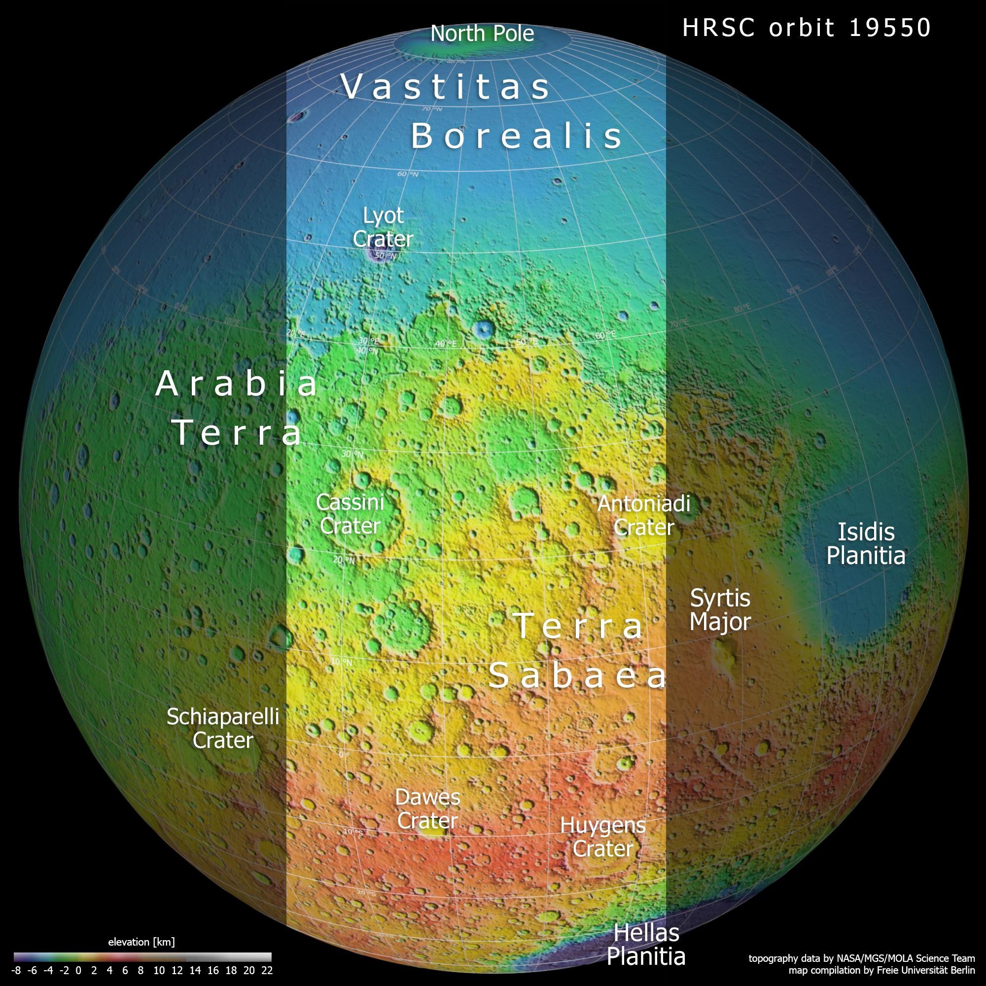
Between 1997 and 2001, NASA’s Mars Global Surveyor spacecraft scanned Earth’s neighbouring planet with a laser altimeter, which recorded high-precision altitude information about the Martian landscape at specific points. This topographical map, based on data from the MOLA (Mars Orbiter Laser Altimeter) experiment, clearly shows the division of Mars into the older southern highlands (coloured green, orange and red) and the younger northern lowlands (blue areas). There is a 2000 to 4000-metre difference in height between these two very different landscapes. The light-coloured section indicates the area imaged by the High Resolution Stereo Camera in June 2019.