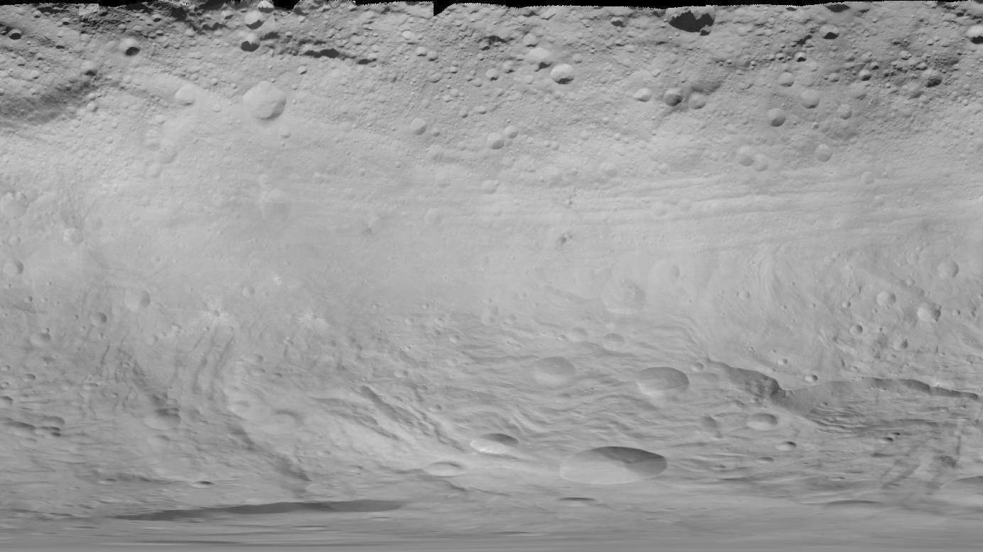
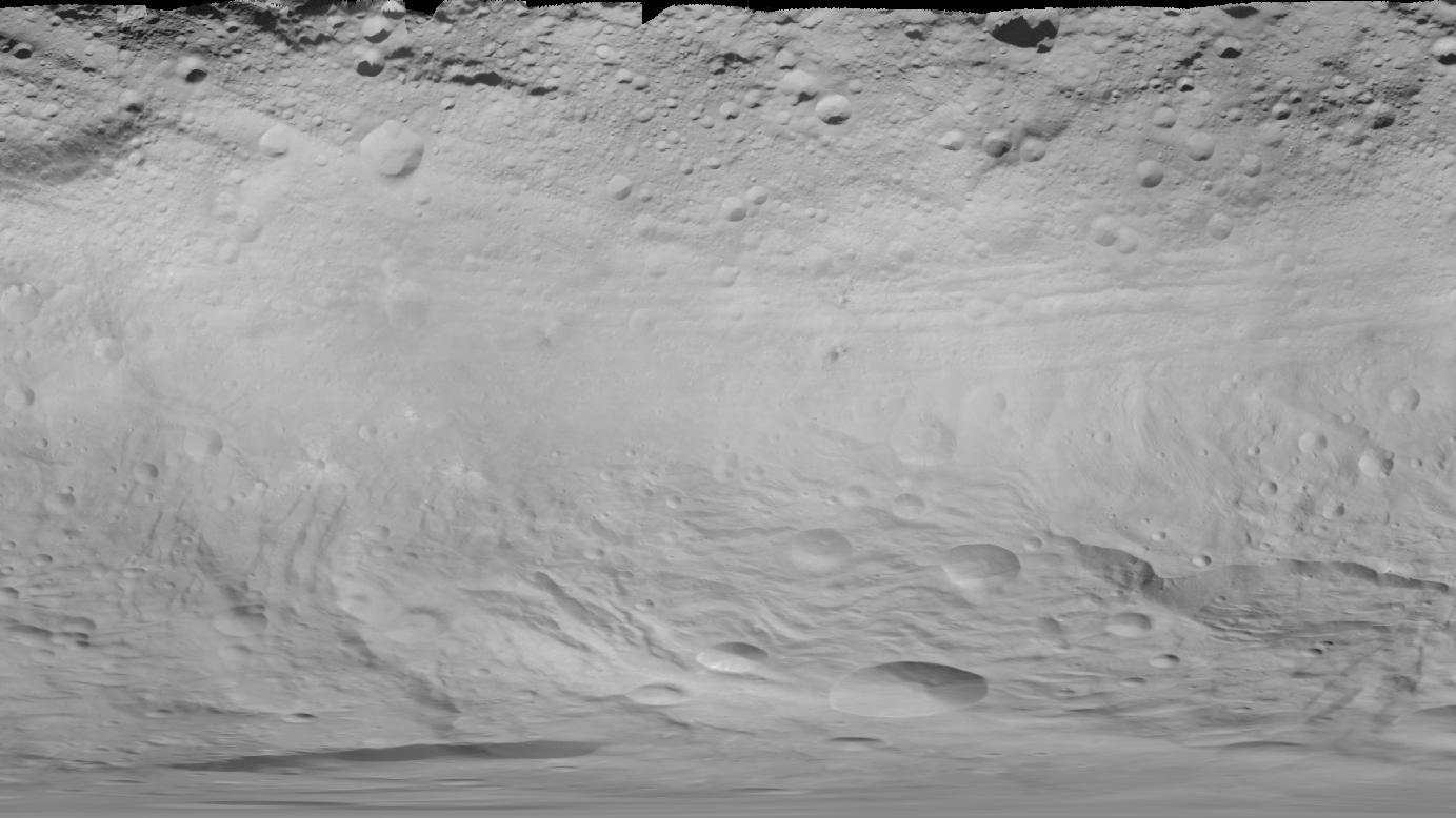
Map of Vesta’s equatorial latitudes and southern hemisphere

Map of Vesta’s equatorial latitudes and southern hemisphere
This is the first global map of asteroid Vesta, composed from images recorded by the framing camera onboard NASA’s Dawn spacecraft. Since July 2011, Dawn has been orbiting the third largest object in the asteroid belt in a survey orbit of approximately 2400 kilometres above the surface, obtaining individual images with the camera’s clear filter with an image resolution of about 250 metres per pixel. The orbit will be progressively lowered so the global mosaic can be improved step by step in terms of resolution.
The equator runs parallel to the upper image border, approximately above the bright, smooth band of troughs. Towards the north pole (top of image), a black, shadowed landscape indicates that Vesta’s northern latitudes are in seasonal shadow due to the northern polar ‘winter’ night lasting through the second half of 2011.
Vesta is an irregular shaped body with semi-major axes measuring 289 kilometres, 280 kilometres, and 229 kilometres, respectively. The map is displayed in a geometry called ‘simple cylindrical projection’; in such a projection, the south pole point is stretched to a line the same length as the equator, forming the lower limit of the image; features in high southern latitudes appear distorted. Image resolution is 750 metres per pixel.