Ontario Lacus, a hydrocarbon sea with a 'beach' on Titan
Ontario Lacus, a hydrocarbon sea with a 'beach' on Titan
Ontario Lacus is a sea close to the South Pole of Titan, one of Saturn's moons, filled with liquid ethane, probably mixed in with liquid methane, nitrogen or other light alkene compounds.
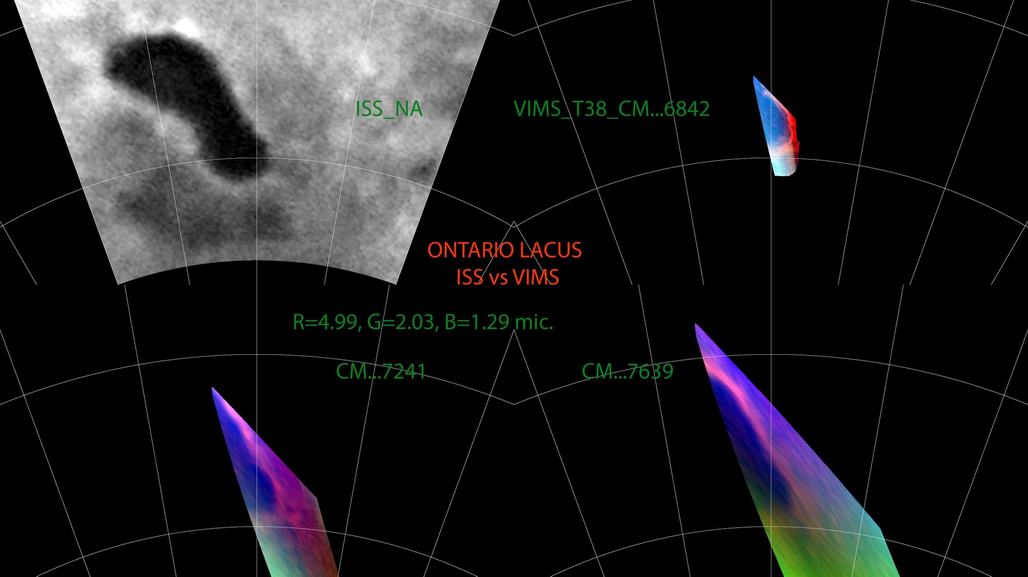
The picture shows the sea in a cartographical projection, firstly in an infra-red image taken by Cassini's ISS (Imaging Science Subsystem, top left) camera and also in three negative images obtained from combinations of images taken through various infra-red filters of VIMS (the Visual and Infrared Imaging Mapping Spectrometer on board Cassini).
The negatives show the south-east section of the sea as a dark blue area. A bright, narrow band can clearly be seen around the sea: it is obviously a transitional zone separating the sea from the surrounding area. VIMS scientists call this 'the beach'. The Cassini camera first photographed the sea in mid-2005, when it showed up as a dark area which hardly reflected any light (ISS-NA, top left). Due to its shape and size, which recalled Lake Ontario, to the east of Niagara Falls on the border between the USA and Canada, it was given the Latin name Ontario Lacus. However, the picture gave no further clues as to the composition and condition of the fluid (or otherwise) in Ontario Lacus.
During one of the later fly-pasts of Titan, on 4 December 2007, VIMS was able to get a picture of the sea from a distance of 1 100 kilometres at the relatively high resolution (for a spectrometer) of 500 metres per pixel. Because of Titan's thick nitrogen and methane atmosphere, actual detail of the surface of the icy satellite can only be registered in specific, narrow wavelengths.

