Las Vegas, USA – First TerraSAR-X Digital Elevation Model

Las Vegas, USA – First TerraSAR-X Digital Elevation Model
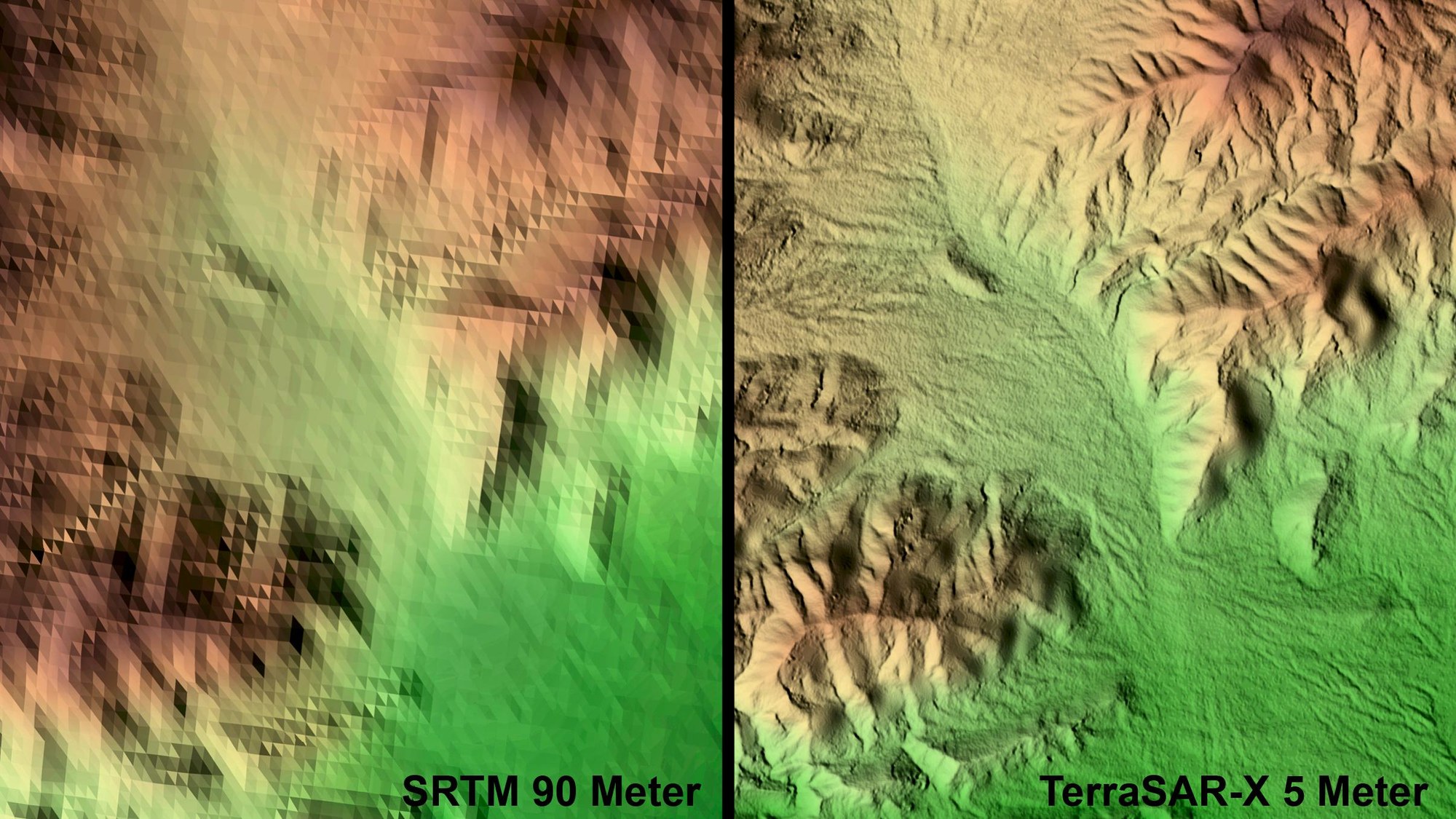
The image shows a section of Las Vegas close to Boulder City. On the right is the high-resolution TerraSAR-X elevation model; for comparison, the elevation model on the left is based on data currently available worldwide, from the Shuttle Radar Topography Mission (SRTM), to which DLR contributed. It dates back to the year 2000. With its radar technology, TerraSAR-X can measure the surface of Earth with extreme accuracy and provide data for ultra high resolution digital terrain models. However, this requires at least two satellite overflights to ensure that the satellite can image the terrain from two different angles. If either rain or wind alter the surface reflectance between two successive passes of the satellite, the quality of the resulting terrain model will be affected. Hence, for the time being, dry areas are the preferred areas for testing the imaging function and elevation derivation, given their low rate of surface change. This limitation will disappear in the future once the projected Tandem-X Mission is operational. This mission will involve an almost identical satellite that will be shot into a quasi-parallel orbit. The two satellites together will work as a tandem, both imaging the same area for an immediate derivation of digital elevation models with a very high spatial resolution.