Cooperation with the Federal Foreign Office: flood information on Chad and ACIS project meeting in Berlin
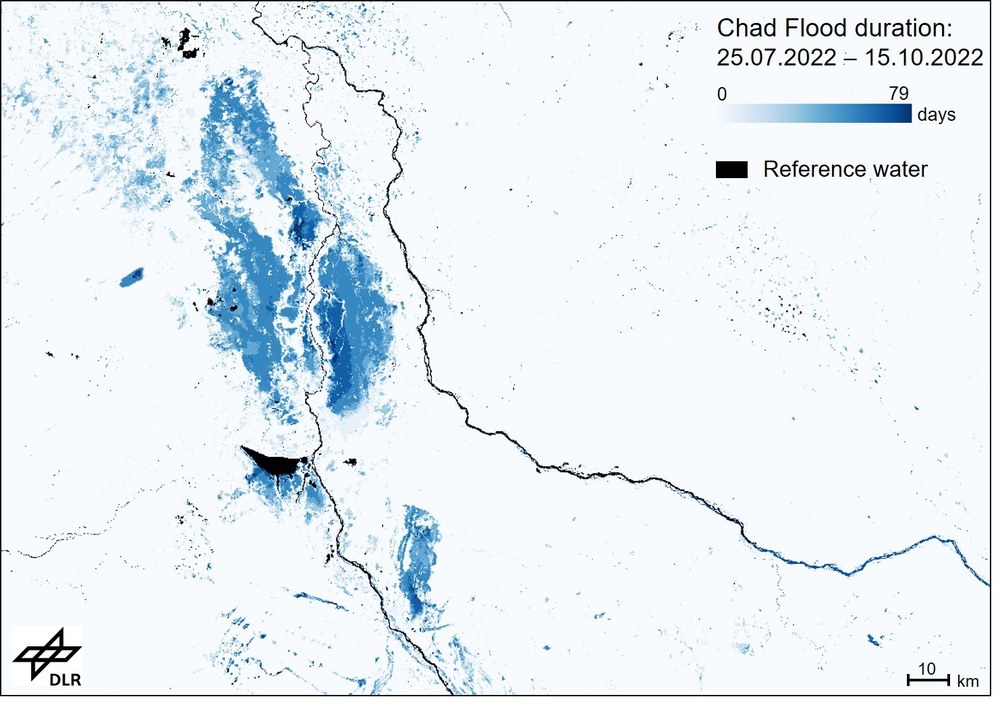
Strong, continuous rainfall since August has led to serious flooding in southern and central Chad. At the request of the Federal Foreign Office, the DLR Center for Satellite Based Crisis Information (ZKI) analysed the flood situation within a few hours and forwarded the information to other institutions, including several embassies in Chad and UN bodies. For various points in time, ZKI used automated procedures to derive flood information from Sentinel-1 satellite data for the affected regions in Chad. In addition, the duration of flooding from July to October in these areas was derived. More information can be found on the ZKI activation site.
The analyses were also presented at a joint ACIS project meeting at the Federal Foreign Office in Berlin. On October 19, 2022 DLR researchers and representative from the University of the Federal Armed Forces Munich introduced their joint IF-Bund project ACIS (“Anticipation of Conflicts using Information from Satellites”). As part of the project, satellite- and geodata-based conflict indicators that could be used by the Federal Foreign Office for early situation assessment were derived for regions of the Sahel zone under study. These also have a potential for conflict modelling.
There is close interaction with the PREVIEW Team of the Federal Foreign Office, which is working on the possibility of early identification of conflicts and making this information useful for decision makers. In this context ACIS provides additional information about satellites and geodata and their potential for use in the early identification of crises. At the project meeting first results were presented and future collaboration discussed.


