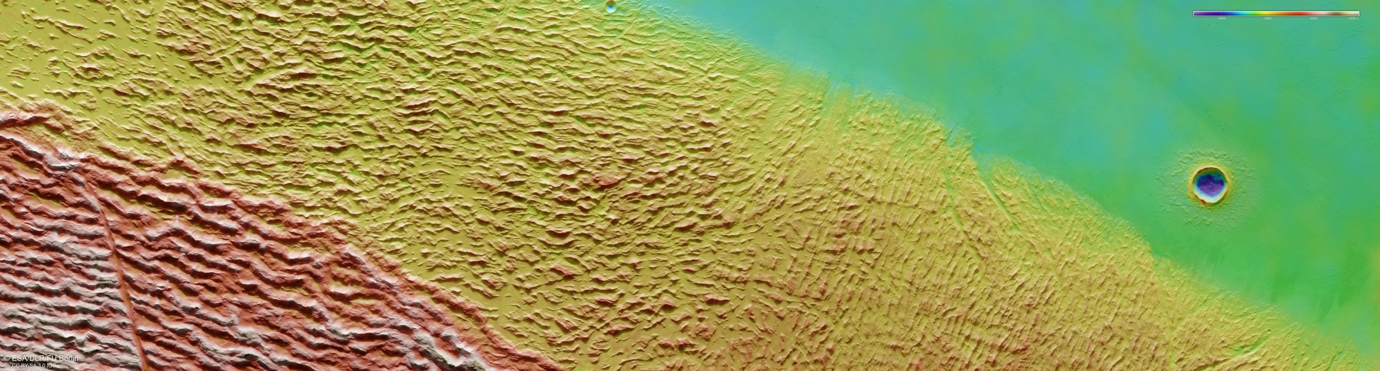
Topographical image map of the transition from Lycus Sulci to Amazonis Planitia

Topographical image map of the transition from Lycus Sulci to Amazonis Planitia
The DLR High Resolution Stereo Camera (HRSC) on board ESA’s Mars Express orbiter uses its nine sensors to acquire images of the martian surface from different angles. Teams of researchers at the DLR Institute of Planetary Research and Freie Universität Berlin compute digital terrain models from data acquired by two stereo channels pointing obliquely forwards and backwards onto the surface, and from the nadir channel pointing perpendicularly onto Mars, which assign height information to each pixel. The colour scale at the top right of the image shows the altitude values in relation to an areoid, an imaginary surface on Mars with constant gravitational attraction. From the highest points of Lycus Sulci in the left (southern) half of the image (red and pink) to the lowest regions of Amazonis Planitia (green) in the northern lowlands, the difference in altitude is just over 3000 metres; the floor of Yelwa Crater, shown in dark blue, is another thousand metres lower.