Topographical map of part of Utopia Planitia


Topographical map of part of Utopia Planitia
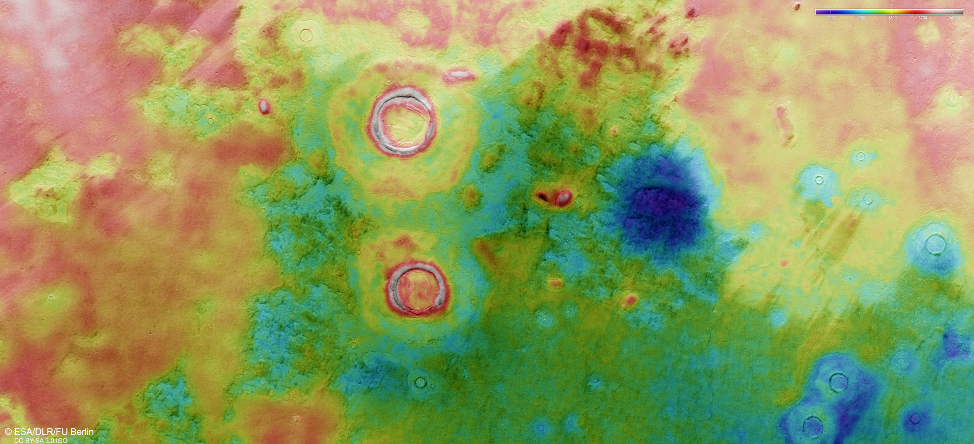
DLR's High Resolution Stereo Camera (HRSC) on ESA's Mars Express orbiter acquires images of the Martian surface at different angles and with four colour channels using its nine sensors, which are each oriented across the line of flight. From the four stereo channels looking at an angle and the nadir channel pointing perpendicularly at Mars, teams of scientists at the DLR Institute of Planetary Research and Freie Universität Berlin compute digital terrain models that assign elevation information to each pixel. The colour scale at the top right of the image shows the differences in altitude in the region. These are not very pronounced in the Utopia lowlands of the northern hemisphere; there is only a 400-metre altitude difference between the lowest areas, coloured blue, and the highest crater rims in the centre of the image, coloured grey. The almost circular, dark-blue depression to the right of the image centre indicates a very old crater that has been almost completely obliterated by erosion. North is to the right of the image.