TerraSAR-X image for route planning during the Endurance22 expedition

TerraSAR-X image for route planning during the Endurance22 expedition
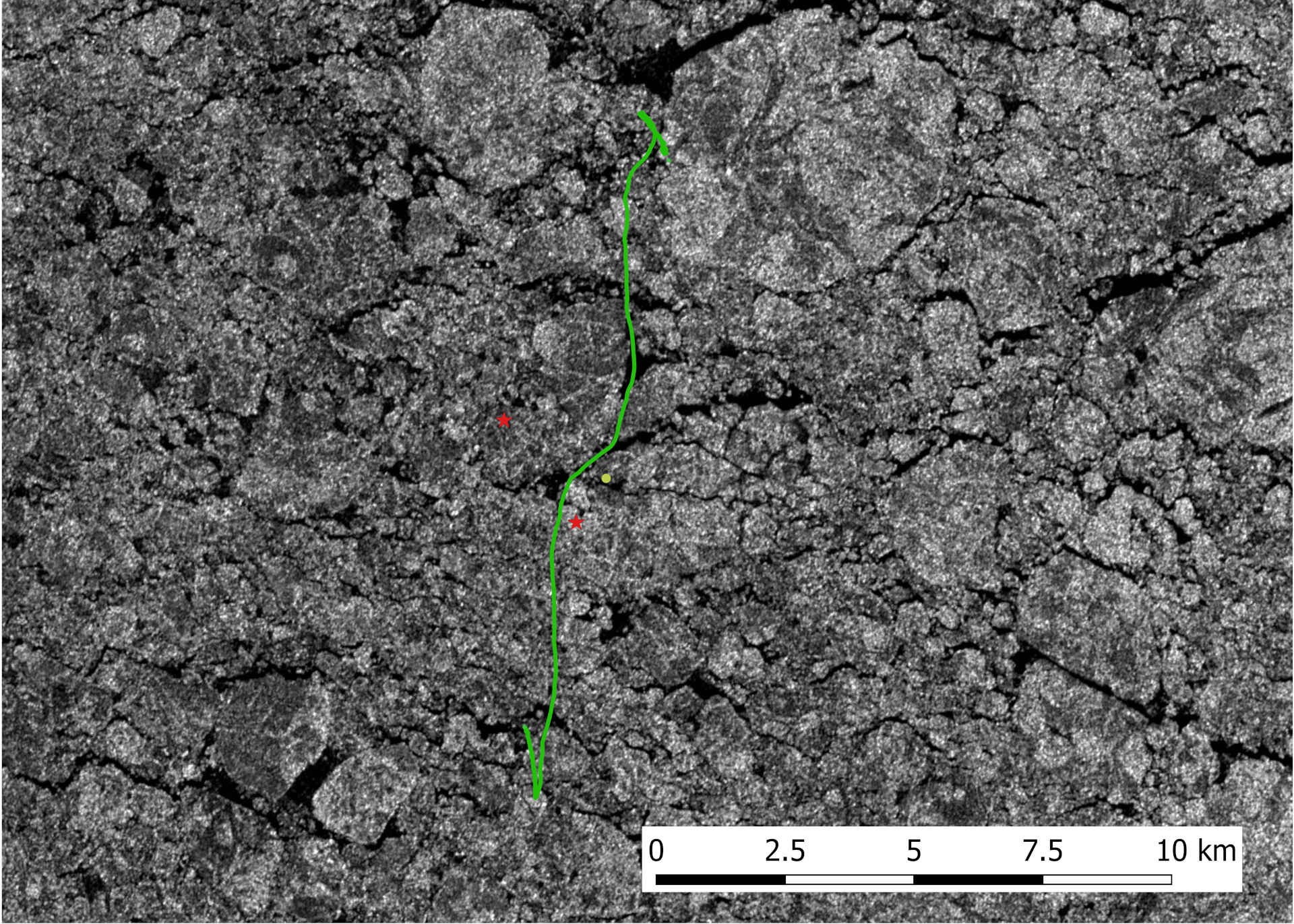
The radar satellite TerraSAR-X makes different structures in the sea ice visible and supports ship navigation in polar regions. The Antarctic 'Endurance22' expedition used TerraSAR-X data as a basis for daily course selection. In this view, the course of the expedition ship S.A. Agulhas II is plotted in green over the radar image. Areas of open water appear in black, ice appears in white.