SECR maps of the Northern and Southern Patagonian Ice Fields

SECR maps of the Northern and Southern Patagonian Ice Fields
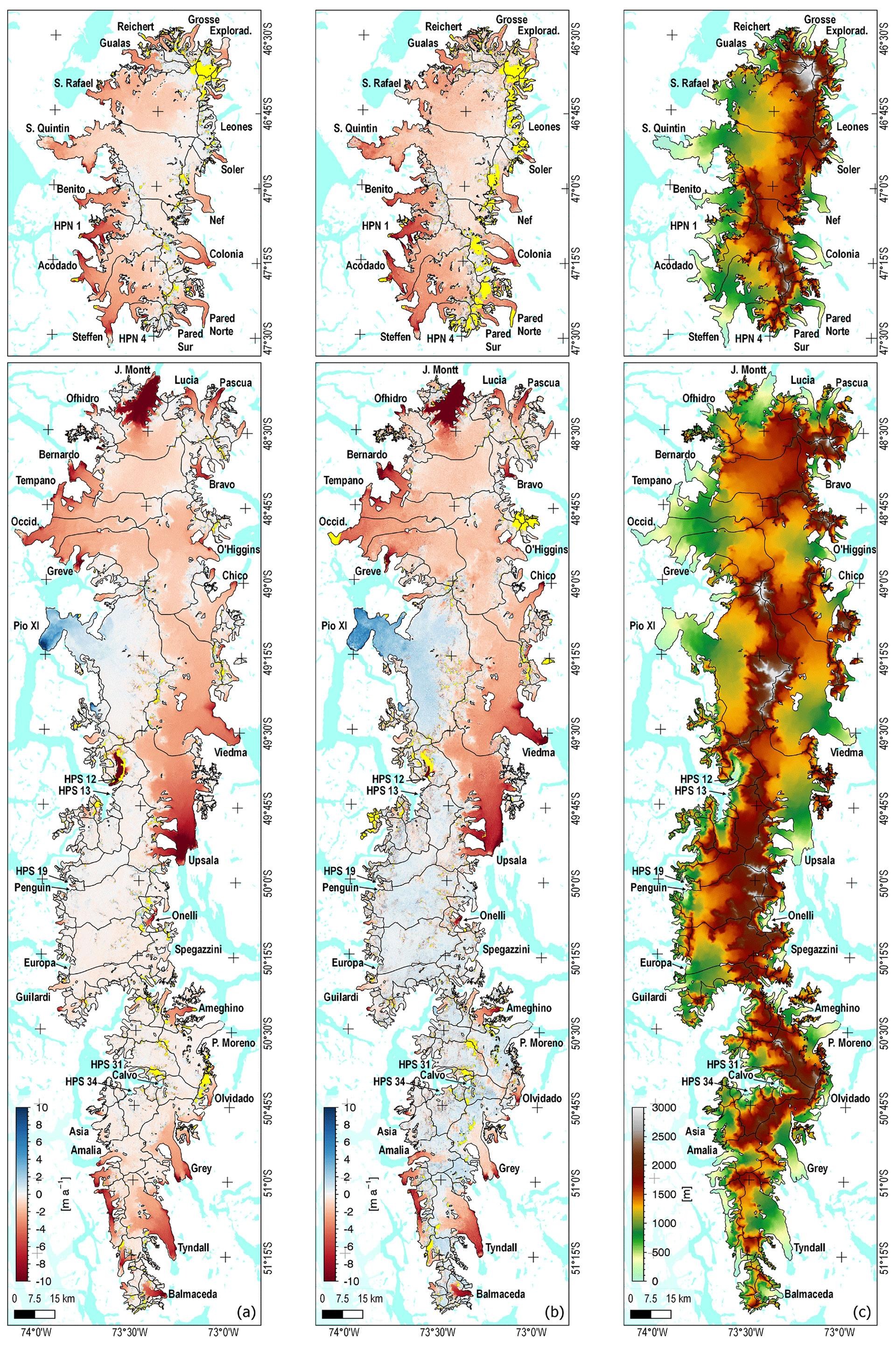
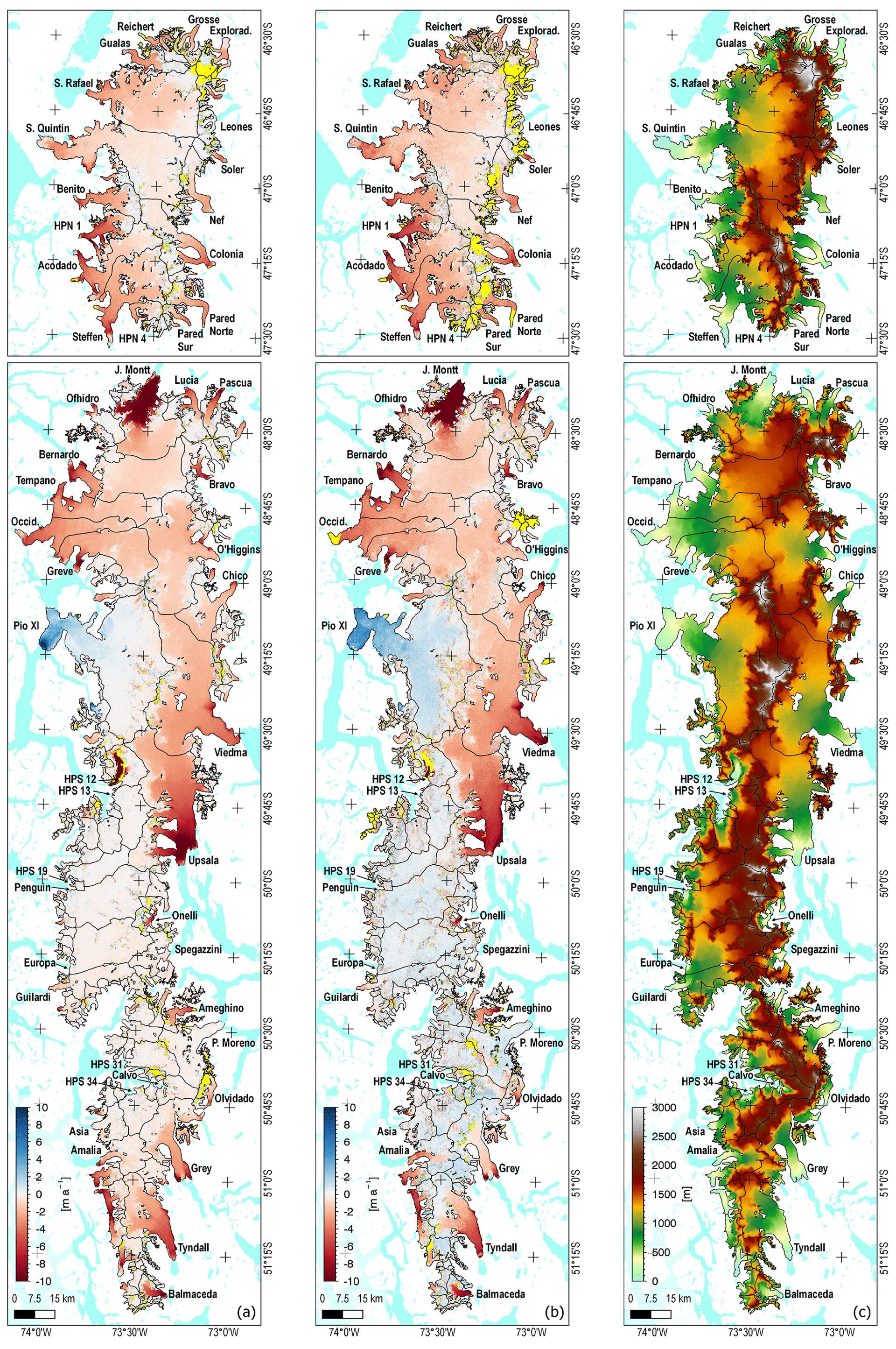
Surface Elevation Change Rate (SECR) maps of the Northern and Southern Patagonian Ice Fields (NPI and SPI); the areas marked in yellow were not surveyed. (a) Epoch one (2000 to 2012) (b) Epoch two (2012 to 2016). (c) Digital elevation model based on TanDEM-X data from 2012 as reference for the geodetic mass balance.