False colour image of the topography of a section of the mountain range in the Thaumasia region

False colour image of the topography of a section of the mountain range in the Thaumasia region
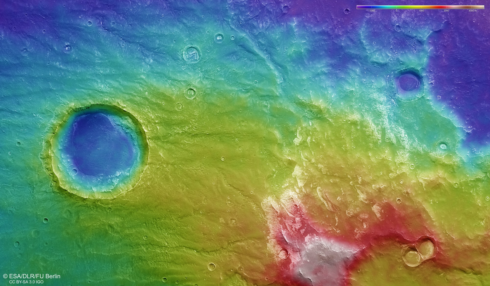
Digital terrain models of the Martian surface with an accuracy of up to 10 metres per picture element (pixel) can be generated from the nadir channel, directed vertically onto the Martian surface, and the stereo channels of the DLR-operated HRSC camera. In this colour-coded image, the absolute elevations above a reference level, the areoid (derived from Ares, the Greek word for Mars), are well depicted. These elevation values can be read based on the colour scale at the top right of the image.