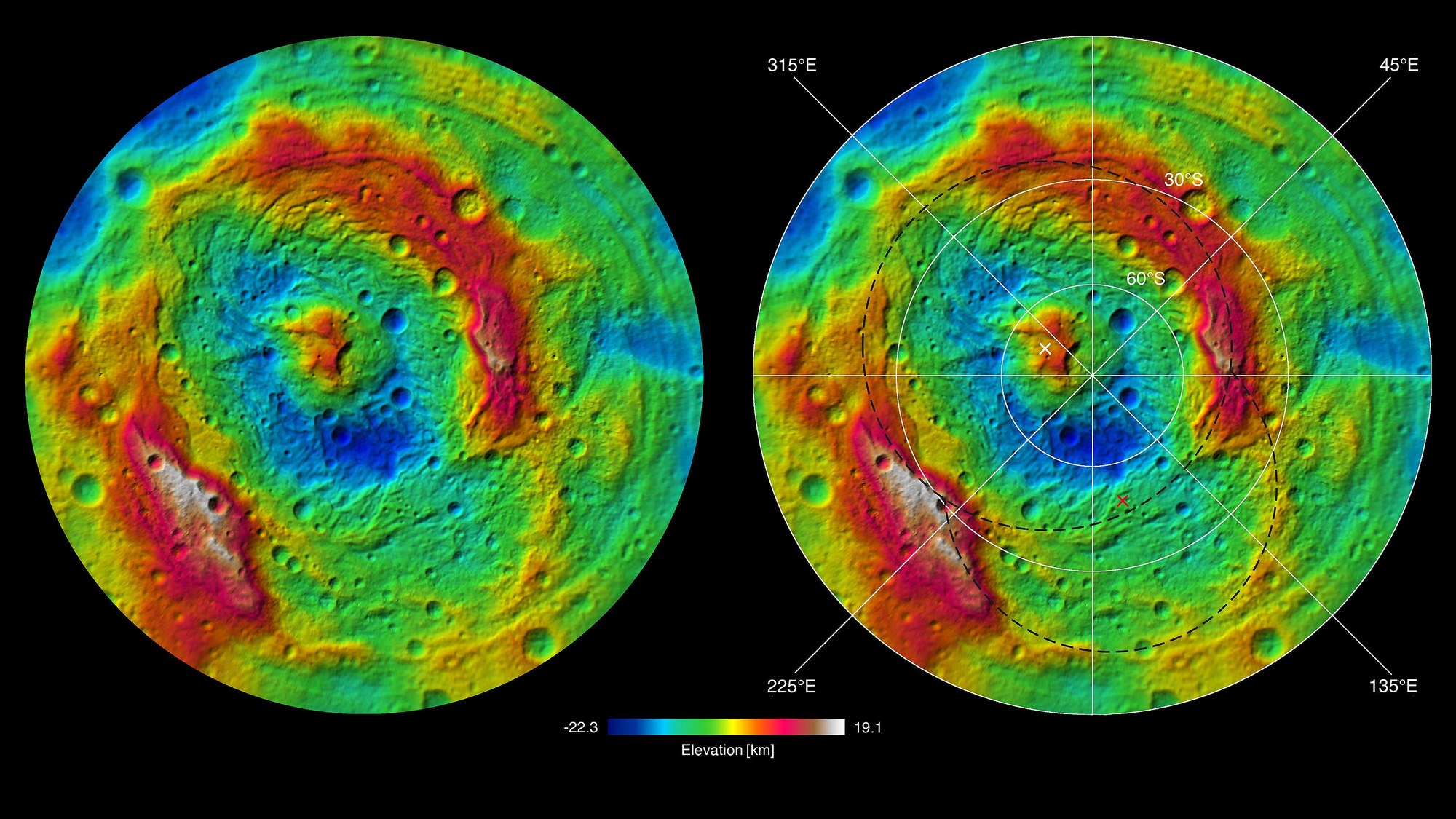
The topographical map reveals a double impact at Vesta’s south pole
The topographical map reveals a double impact at Vesta’s south pole
Observations with the Hubble Space Telescope hinted that the south pole of the approximately 500-kilometre asteroid Vesta was somewhat flattened. With the images acquired by the Dawn spacecraft, it became obvious that there is a huge impact basin, with a diameter of 500 kilometres. It has been named Rheasilvia, after one of the Vestal Virgins of ancient Rome.
DLR has computed topographical maps of asteroid’s surface from stereoscopic image data; these reveal the extent of this cosmic collision (red and white – elevated areas; green and blue – low regions). The impact left a 500-kilometre wide and, in some places, more than 10-kilometre deep basin surrounded by a ring of elevated rock. In the centre of Rheasilvia is a more than 20-kilometre high central peak. What surprised the researchers was the discovery of a second, older basin with a diameter of 400 kilometres, which was named Veneneia. In the right-hand image, dashed lines indicate the outlines of Rheasilvia and Veneneia. The centres of the basins are each marked with an ‘X’.

