Map of Vesta’s south pole


Map of Vesta’s south pole
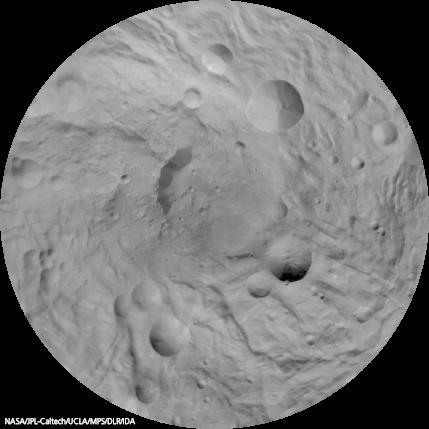
This image mosaic of Vesta’s south pole has been generated from dozens of individual images obtained with the framing camera onboard NASA’s Dawn spacecraft. The images have been recorded from an altitude of about 2400 kilometres above the asteroid’s surface.
The image map is centered on the asteroid’s south pole, which is surrounded by several large impact craters with diameters of 20 to 50 kilometres. The mosaic is displayed in a stereographic projection; image resolution is 750 metres per pixel. The outer edge of the circular map corresponds to a latitude of 50 degrees south.