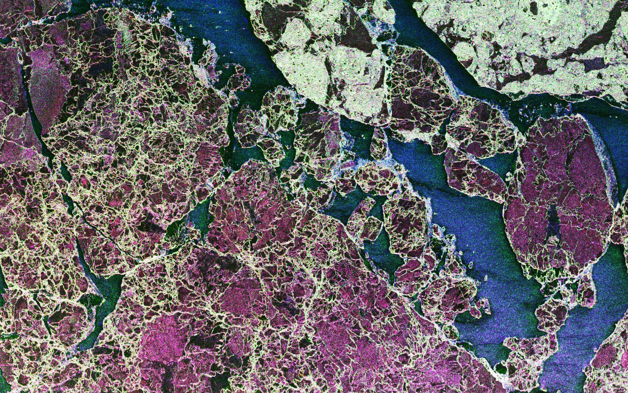
Sea ice near Spitsbergen, Barents Sea, Arctic Ocean
Sea ice near Spitsbergen, Barents Sea, Arctic Ocean
Sea ice in the Barents Sea east of Spitsbergen, (approx. 600 miles from North Pole). The Barents Sea is part of the Artic Ocean. The image originates from a joint campaign of DLR-HR with the Alfred-Wegener-Institute (AWI), Bremerhaven, Germany. Both optical and SAR images were acquired during the campaign for the study of sea ice.
Location: Barents Sea, Spitsbergen, Norway
Time: 20 April 2005, 13:37-13:53 (UTC)
Instrument: E-SAR
Platform: Aircraft (Dornier Do228-212)
Wavelength: 23cm (L-Band)
Polarisation: HH-HV-VV (red-green-blue)
Image Content: Radar reflectivity in three polarisations
Image Geometry: Slant range projected to ground (ground range)
Image Size: 3136x 1964 (cutout from original image)
Pixel Size: 0.94m x 1.49m (flight direction x slant range)
Resolution: 2.50m x 2.20m, looks: 4 x 1

