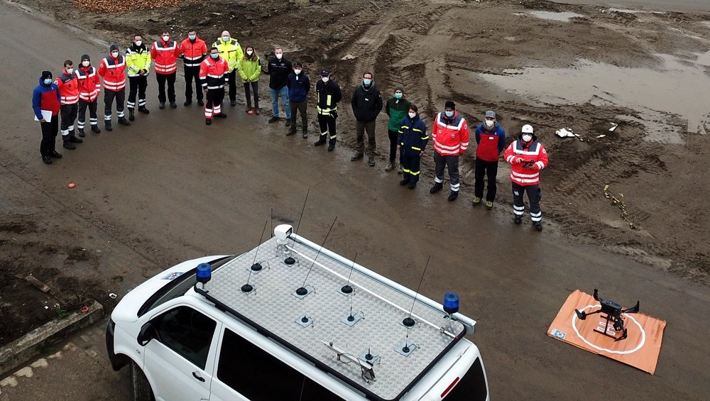
Exercise and UAV flight campaign in Ahrtal as part of the AIFER project
On October 22/23, 2021 an exercise and flight campaign with Unmanned Aerial Vehicles (UAV) has been coordinated jointly by the Bavarian Red Cross (BRK), Department Rettungsdienst – Sicherheitsforschung and the German Aerospace Center (DLR) – Center for satellite-based crisis information (ZKI) in the Ahrtal region. Together with participants from Bergwacht Rhön-Spessart, BRK Kreisverband Rhön-Grabfeld, Technisches Hilfswerk, Malteser Hilfsdienst Neuwied, Landesfeuerwehrverband Rheinland-Pfalz, DRK Kreisverbände Ahrweiler and Neuwied as well as representatives of the Bundesamt für Bevölkerungsschutz und Katastrophenhilfe (BBK) various aspects of the usage of UAVs in emergency response were discussed and practiced.
The exercise took place in Altenahr and Altenburg, which have been severely affected during the floods in July 2021. Besides a „DJI Mavic Platinum“ UAV of the BRK, which has been used for exploration and test flights, a „DJI Matrice M300 RTK“ UAV of the Bergwacht Rhön-Spessart has been deployed for data acquisition.
The main objective of the flight campaign has been to collect data for generating digital orthoimages and digital surface models of most affected areas. These data form a valuable basis for development of methods for automated image analysis in the context of crisis mapping. By comparison of the UAV data with aerial images acquired before and during the flooding it is envisaged to detect and document changes such as damages or reconstruction efforts. Furthermore, the exercise has been an important test to integrate data from on-site responders into existing crisis mapping workflows. It also has been an important forum for the participants to exchange their experiences with data acquisition and distribution in disaster situations in general and in particular during the floods in July 2021.
The exercise has been organized in the context of the German-Austrian research project AIFER (Artificial Intelligence for Emergency Response). AIFER develops machine learning methods to extract and fuse crisis-relevant information from satellite-, aerial and UAV-images as well as geo-social media in support of emergency response. Besides technical and scientific tasks, the project specifically tackles legal, social and ethical aspects of the use of artificial intelligence and focuses strongly on integrating end-user’s needs into its developments. The main objective of the project is to contribute to dynamically updated situational awareness and support targeted decision making in emergency response. The project is funded by the German Bundesministerium für Bildung und Forschung (BMBF) as part of the programme „Forschung für die zivile Sicherheit“ and by the Austrian Bundesministerium für Landwirtschaft, Regionen und Tourismus (BMLRT) as part of the „Förderungsprogramm für Sicherheitsforschung (KIRAS)“.
Links


