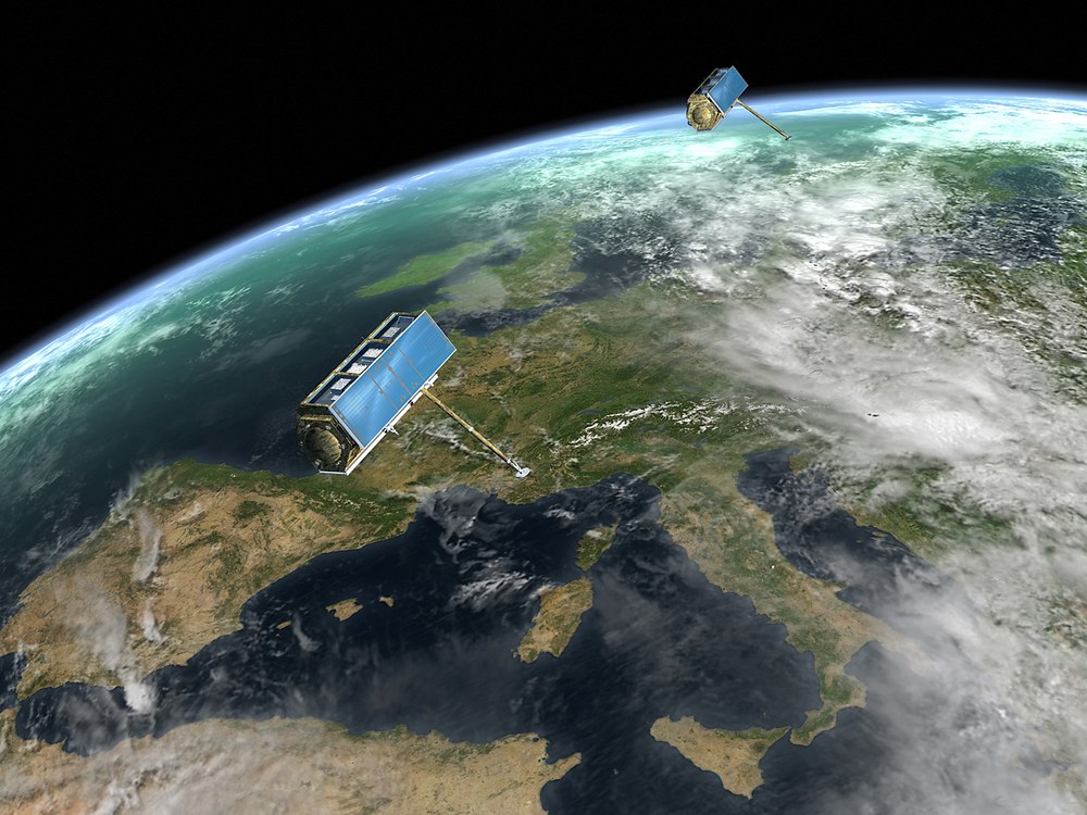
TanDEM-X
Launch: 21. June 2010
Like the two eyes that enable people to see in three dimensions, its two antennas make TanDEM-X the first-ever system capable of generating a three-dimensional elevation model of the entire surface of the earth. Moreover, the two satellites are equipped with devices to synchronize the two radar instruments as well as with an autonomous on-board navigation controller. To complete the system, there is a highly complex ground segment which also supports the ongoing operation of the TerraSAR-X mission.
TerraSAR-X has already been launched on a Dnepr rocket from the Baikonur cosmodrome in Kazakhstan on June 15, 2007. TanDEM-X is scheduled to follow in the first half of 2010. From then on, the two satellites will fly in formation in their 514-kilometer orbit. They will be traveling extremely closely together at a distance that may occasionally shrink below 200 meters. For the first time ever, this second radar sensor in space will permit generating a global digital elevation model with a vertical resolution of two meters. The horizontal grid will measure twelve by twelve meters.
A global 3-D elevation model will be realized in three years of tandem flight
What is more, the two satellites will be the first configurable SAR interferometer in space. In bi-static operation, one of the two satellites will emit radar signals while the backscatter from the earth's surface will be received by both. To cover the entire globe, three years of parallel operation will be required, with the satellites flying in formation. Within this period, the satellite tandem may survey the earth's entire land surface of 150 million square kilometers. The data volume generated in the process, approximately 1.5 petabyte, beats anything that has ever been recorded before. If it were transferred to DVDs and the disks were stacked up, they would form a column more than 430 meters in height - 100 meters higher than the Eiffel tower.
The TanDEM-X project is a step that logically follows from international radar missions like X-SAR (X-Band Synthetic Aperture Radar) and SRTM (Shuttle Radar Topography Mission) as well as from the successful completion of the national TerraSAR-X project. The X-SAR instrument has already completed two successful ten-day missions on board the space shuttle in April and September 1994. Reconfigured as an interferometer, it was employed again on the SRTM mission in February 2000. During the mission, an area of land was scanned by two radar systems and the resultant data were used to generate an elevation model of the earth's surface.
TanDEM-X: A mission in public-private partnership
TanDEM-X is being realized in a public-private partnership in which the industrial sector is financially involved: while DLR is responsible for the overall management, the ground segment and operations, EADS Astrium is in charge of developing, building and launching the satellite.
The Tracking, Occultation and Ranging Experiment (TOR) supplied by the Potsdam GeoForschungszentrum (GFZ) forms an important part of the TanDEM-X satellite payload. It consists of a dual-frequency GPS receiver which permits determining the orbit of the satellite down to a few centimeters. In addition, the receiver may be used to measure radio occultation in the atmosphere and ionosphere.
The overall cost of the space segment including its launch amounts to around 85 million Euros, to which DLR will contribute c. 59 and Astrium GmbH Friedrichshafen about 26 million Euros. The cost of building the ground segment and operating it for five years has been estimated at around 60 million Euros. Of that sum, about 45 million will be provided by DLR, while the remaining 15 million Euros will be supplied by Infoterra, a fully-owned subsidiary of Astrium which will market TanDEM-X data on an exclusive basis.
Mission parameters
Launch | first half of 2010 |
Site | Baikonur, Kasachstan |
Launcher | Dnepr-1 |
Orbital height | 514 km |
Inclination | 97.4221 degrees |
Satellite mass | 1350 kg |
Dimensions | 5 m x 2,4 m |
Power consumption | 800 W |
Mission operating | German Space Operations Center, DLR Oberpfaffenhofen |
Satellite commanding | DLR ground station Weilheim |
SAR data reception | Kiruna (north Sweden), Inuvik (Canada), O'Higgins (Antarctic) |
Lifetime | 5 years, 3 paralell operation with TerraSAR-X |


