
CATENA

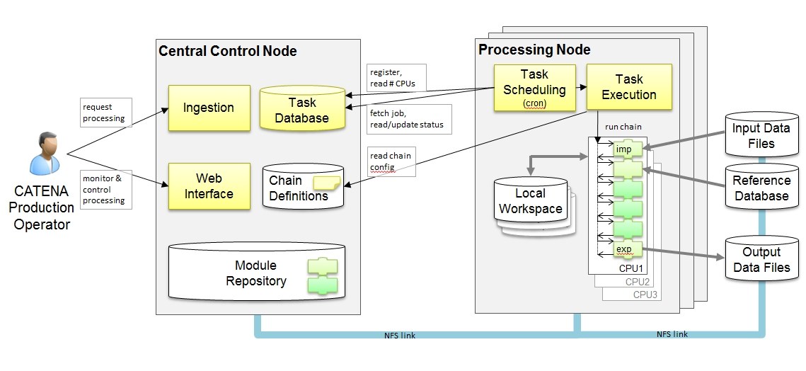
Catena (lat. for chain) is a universal, operational infrastructure to set up processing chains for the automatic processing of (optical) satellite and airborne image data. The standard chain generates orthorectified images from the original satellite images using a worldwide reference image database. For this task ground control points are automatically extracted from the satellite image and the reference images.
Using these points, the attitude and ephemeris data of the satellite can be corrected and the original image can be orthorectified using a high-resolution digital elevation model. Afterwards, automatic atmospheric correction of the image is performed. Subsequently, thematic processors like e.g. for land cover extraction or change detection can follow the standard chain.
Also, some input data can trigger completely different chains. For example, the stereo imagery delivered by the Indian satellite Cartosat can be used to in a chain which automatically generates a digital elevation model from those stereo images. The data of more than 25 different sensors can be processed in more than 30 different processing chains. The generic and modular architecture of Catena allows for an easy expansion to data from new sensors and/or new algorithms.