Valley of the Kings and the city of Luxor


Valley of the Kings and the city of Luxor
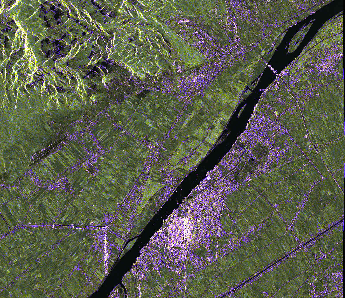
The image, acquired in high-resolution 'sliding spotlight' mode, shows the Valley of the Kings (at the top of the image) and the city of Luxor (in the lower part of the image). This TanDEM-X image from January 2023 has an extent of 10 kilometres by 12 kilometres (flight direction by ranging direction) and a resolution of 2.2 metres by 2.8 metres. The Nile stands out in deep darkness in the radar image because its water surface acts as a mirror for radar signals. Due to the sideways-looking imaging geometry, it reflects the signals away from the satellite. Relatively smooth surfaces such as fields or fallow land are coloured green in this image, while uneven surfaces such as urban areas are coloured purple.