
Fig. 3: Hydrodynamic model of water flow near the "Lizard" geoglyph, whose tail was cut off by the Trans-American Highway before its discovery.
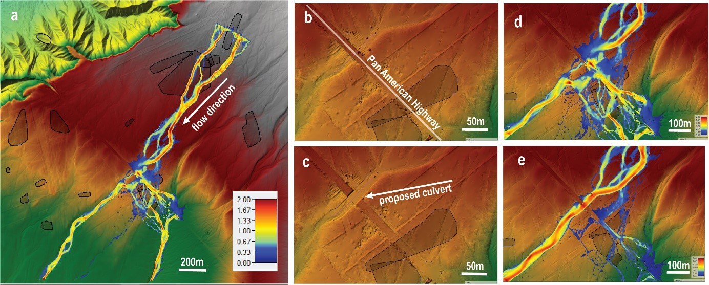

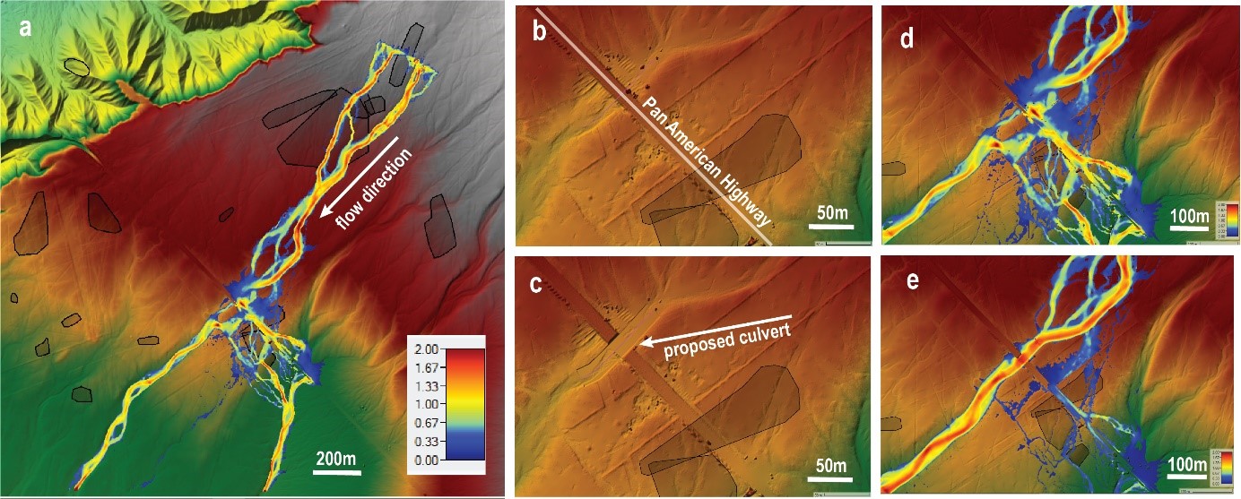
Fig. 3: Hydrodynamic model of water flow near the "Lizard" geoglyph, whose tail was cut off by the Trans-American Highway before its discovery.
The simulation suggests that a culvert may protect the valuable geoglyph from flooding. The terrain model was derived from LiDAR data.