Skip to main content
Skip to navigation
Skip to footer
DLR Portal
Press
Accessibility
de
en
Earth Observation Center
About us
About us
Research & Transfer
Research & Transfer
Latest
Latest
Multimedia
Multimedia
Careers & Education
Careers & Education
>
About us
>
Remote Sensing Technology Institute
>
Photogrammetry and Image Analysis
>
Public Datasets
>
>
VETRA: A Dataset for Vehicle Tracking in Aerial Imagery
>
VETRA dataset locations
Home
>
About us
>
Remote Sensing Technology Institute
>
Photogrammetry and Image Analysis
>
Public Datasets
>
VETRA: A Dataset for Vehicle Tracking in Aerial Imagery
>
VETRA dataset locations
VETRA dataset locations
VETRA dataset locations
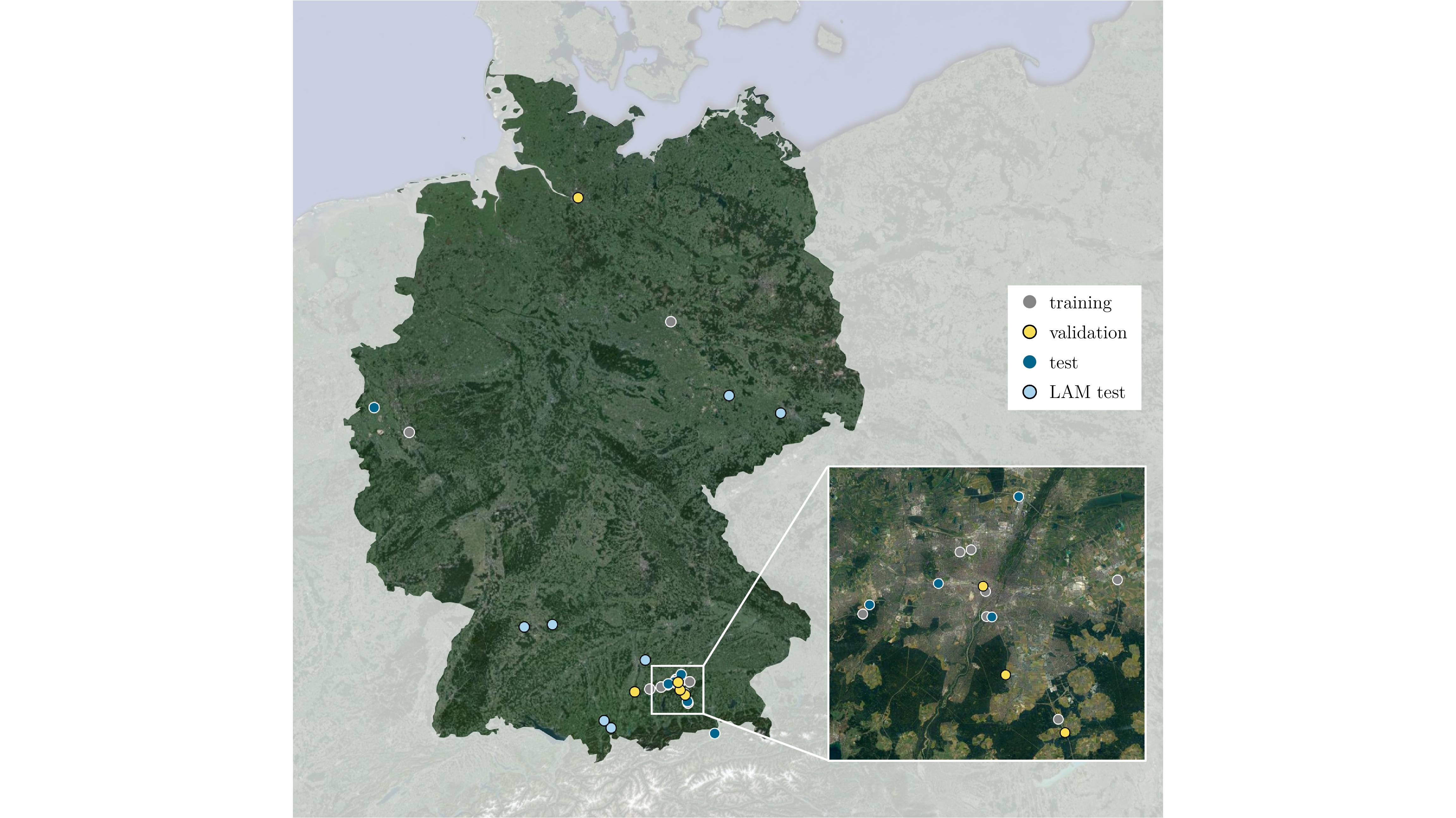
Figure 3: Locations where VETRA sequences were captured. For LAM test set, each data point represents 4 sequences.
Credit:
DLR (CC BY-NC-ND 3.0)
Download
Download


