What is new about the German radar satellites?

Earth is a complex and dynamic system and radar remote sensing is designed to deliver quantitative 3D and 4D information about the planet's surface. The latest research results and information products obtained from high-resolution data acquired by the German satellites were presented during the TerraSAR-X and TanDEM-X Science Team Workshop, which was held at the German Aerospace Center from 18 to 20 October 2023.
Inspired by the launch of the TerraSAR-X satellite in 2007 and its twin TanDEM-X in 2010, a series of TerraSAR-X and TanDEM-X Science Team Workshops were initiated to present the latest status of the missions, to promote scientific exchange and reveal the latest results obtained using the acquired data.
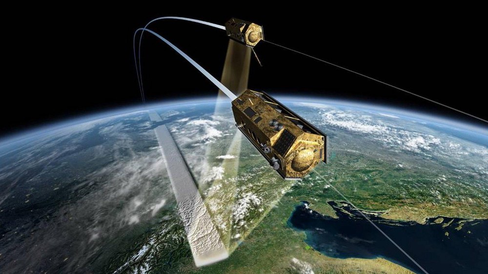
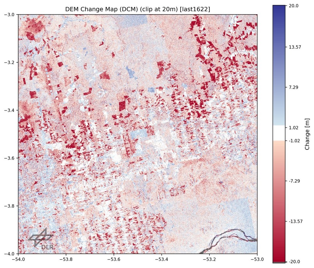
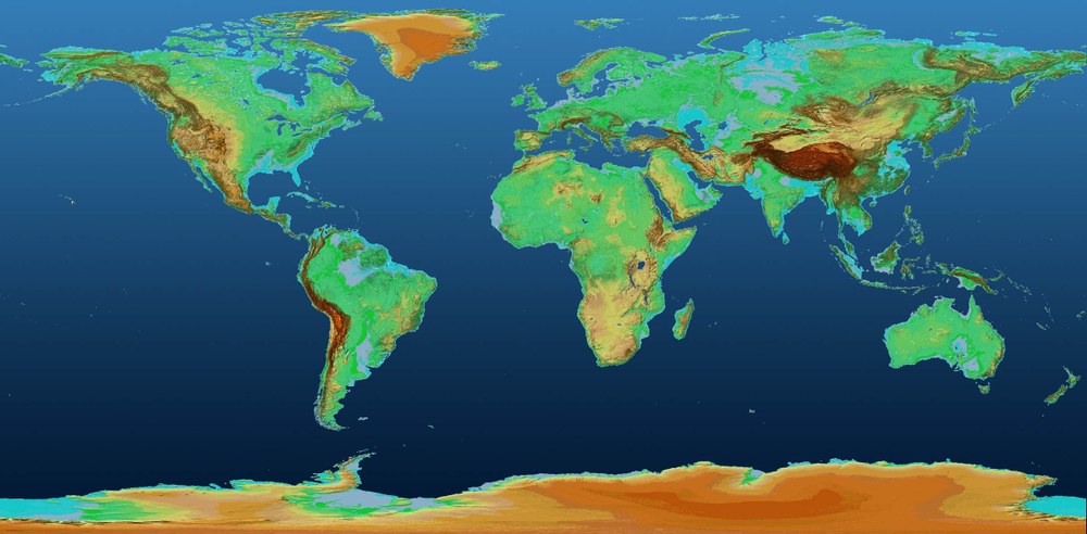
TerraSAR-X and TanDEM-X have been providing high-quality, high-resolution Synthetic Aperture Radar (SAR) data for 16 and 13 years respectively. Since 2016 a global and consistent Digital Elevation Model (DEM) with unprecedented accuracy has been available, created using interferometric data acquired by the TanDEM-X mission. Shortly after the Science Team Meeting, the latest information product – the TanDEM-X DEM Change Map – will be presented and made available to interested scientists. The TanDEM-X DEM Change Map is a 30-metre spatial resolution information product showing the topographic changes between the first (2010-2015) and second (2017-2020) global acquisition of the TanDEM-X mission – shown as an example in Figure 1. In addition, researchers at the DLR Microwaves and Radar Institute are working on an update of the global DEM, the TanDEM-X DEM 2020, which will be completed by mid-2024.

In addition to providing SAR images and DEMs, the missions are supporting applications based on innovative imaging techniques – for example, differential and along-track interferometry, digital beamforming, tomography and polarimetric SAR interferometry.
For the TerraSAR-X and TanDEM-X Science Team Workshop we received more than 160 excellent submissions and had three days of intensive scientific exchange at the DLR campus in Oberpfaffenhofen. The workshop started with a common session for both missions on Wednesday morning (18 October), which provided general information about the status of the missions. Thematic sessions (Agricultural, Forest, Ocean, Georisk and Geotectonics, Permafrost, Ice and Snow, Hydrological, Urban, DEM and Methods) for both missions were held from Wednesday morning until midday on Friday (20 October) and included 74 oral and 23 poster presentations.

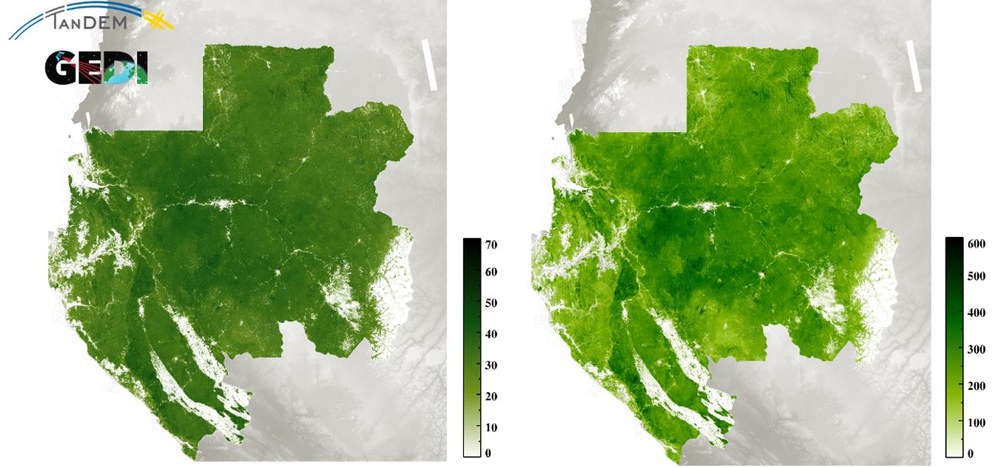
The presentation of the first biomass map derived from a data fusion between TanDEM-X elevation data and NASA Global Ecosystem Dynamics Investigation (GEDI) lidar waveform data created a 'wow' effect. The map was developed in a cooperation between scientists from the University of Maryland and DLR. TanDEM-X measured heights over the forest, and the forest structure parameters obtained from the GEDI mission were merged to generate a forest height map. This forest height map was then used to create a forest structure map, which was then converted into a forest biomass map without the use of any reference data. By merging the products of the two satellite missions, it was possible to achieve an accuracy of better than one metre for the forest height map, which shows how important synergies can be.

During the morning of 18 October 2023, a joint session with participants of the CEOS WGCV SAR Workshop was conducted focusing on current and future international missions.

Author of this article:
Professor Irena Hajnsek (DLR Microwaves and Radar Institute)
Tags:
