Article from DLRmagazine 174: A website shows the performance of different satellite navigation systems
The best signal
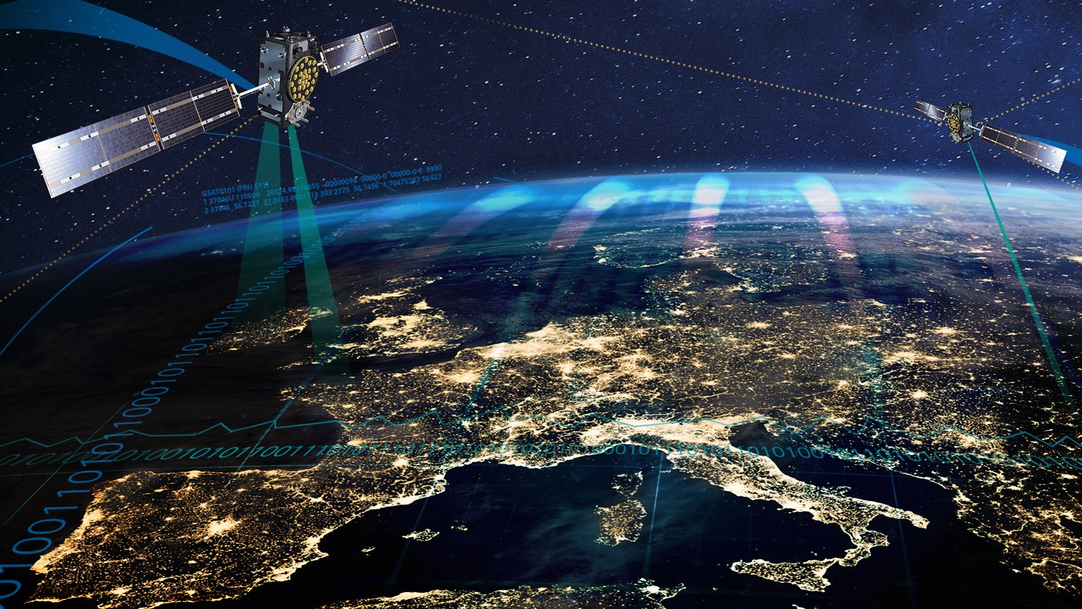
Satellite navigation has become an indispensable tool in our daily lives
For example in the fields of mobility, agriculture and energy supply
Credit:
DLR/Nicolas Herrbach - stock.adobe.com
In our connected world, satellite navigation is an indispensable tool for our daily lives – from finding the nearest café to the use of fertilisers in agriculture. Several countries have their own Global Satellite Navigation Systems (GNSS). DLR scientists are investigating the factors that influence their performance. They have developed methods to monitor the performance of the four existing GNSS – Galileo (EU), GPS (USA), GLONASS (Russia) and BeiDou (China) – and some of the analyses and results are available on the web for all interested parties.
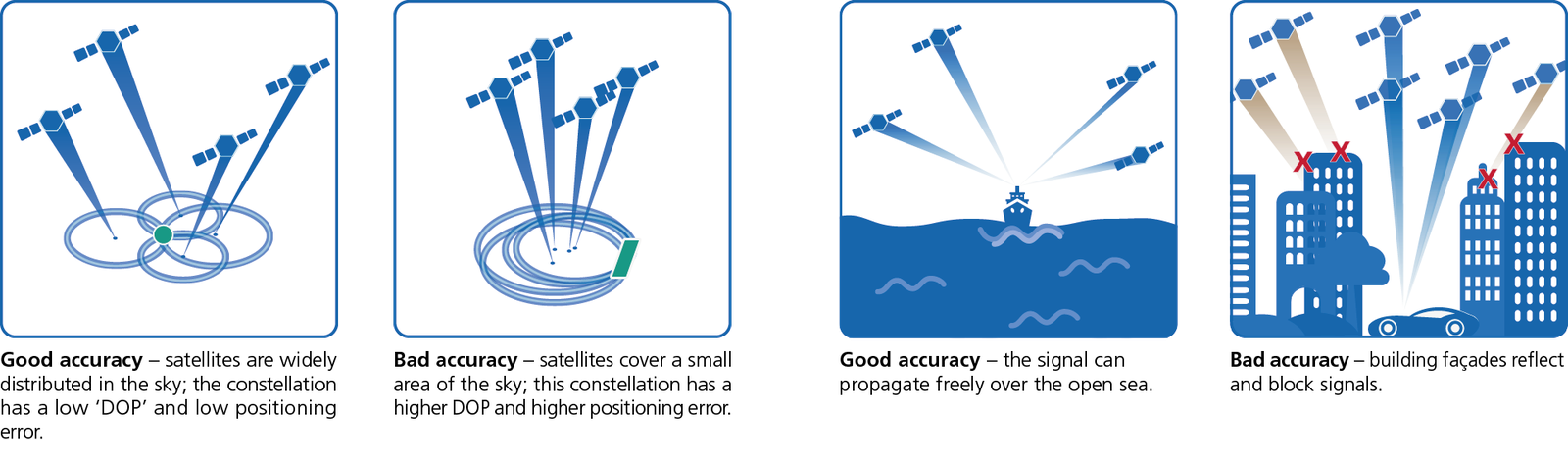
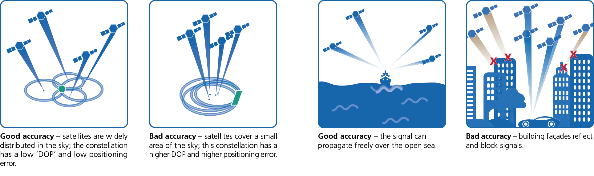
All GNSS use a network of satellites that orbit Earth in fixed trajectories. They continuously send out signals containing information about their position and the precise current time. GNSS receivers, such as those found in professional geodetic instruments, smartphones or car navigation systems, collect data from satellites within range. From this information and the travel time of the signals, they calculate their position, velocity and time. For a receiver on Earth to determine its position, it needs data from at least four satellites. The more satellites there are, the more stable and accurate the positioning becomes.
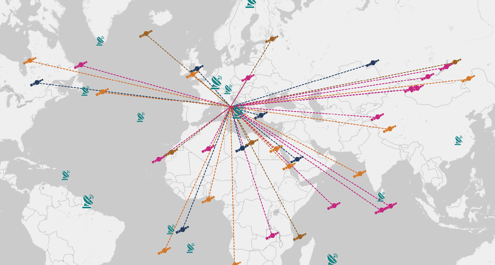
GNSS-Systems
The more evenly distributed the satellites are, the better the positioning at the selected station. Colours correspond to the four GNSS systems: blue for Galileo, orange for GPS, brown for GLONASS and pink for BeiDou.
Each GNSS uses its own satellite constellation, partially at different frequencies and with different signal processing algorithms. As a result, Galileo, GPS, GLONASS and BeiDou differ in terms of accuracy, coverage and robustness. This can have a significant impact on users in different regions and under different environmental conditions. Which signals GNSS receivers choose to use depends on the user location and many other parameters that affect their performance. For example, the number of satellites visible to a receiver and their geometric arrangement in the sky has a huge impact on positioning accuracy. These factors are quantified in the 'Dilution of Precision' (DOP). The DOP depends on how well GNSS satellites are distributed across the sky and their position with respect to the receiver. There are better and worse constellations. Signals can also be inhibited on Earth: in deep urban canyons, for example, signals can be blocked by buildings or reflected by surfaces, and even the atmosphere can cause significant signal delays and distortions. Free electrons in the ionosphere will also deflect signals from GNSS satellites, delaying them as they pass through this layer on their way to a receiver on the ground.
Positioning accuracy
For a receiver on Earth to determine its position, it needs data from at least four satellites. The more satellites there are, the more stable and accurate the positioning becomes.
The quality of the atomic clocks on each satellite is also very important. Since position determination is based on the difference in time between the transmission and reception of signals, precise time-keeping is crucial. The slightest inaccuracy leads to a significant error in the calculated position; an error of one millisecond, for example, can make a difference of 300 kilometres.
The observation and navigation data collected in this project are archived in a long-term database, and experts can use the data to make statements about the signal and service quality of all global navigation systems. They can also produce short and long-term analyses, as well as trends and comparisons. This allows users to assess the accuracy, availability and reliability of their position in different regions, at different times and with different navigation systems.
Although operators regularly publish the performance of each global navigation system, it is difficult to make direct comparisons, because parameters are calculated differently. The DLR platform uses a consistent database with the same calculation methods and indicators for every system, making it possible to draw parallels between each. Another goal of the website is to use the analysed data to contribute to the further development of GNSS. The public nature of the data sources and transparency of the methodologies also helps to stimulate further research and dialogue. Last but not least, it invites users to improve their knowledge of satellite navigation in an entertaining way.
DLR's Galileo Competence Center
GNSS-Performance-Monitoring Website
Lukasz Greda, GNSS Performance Monitoring Project Manager, from DLR's Galileo Competence Center explains the website.
Established in 2019 in Oberpfaffenhofen, the centre supports Europe in providing citizens with the best possible navigation technologies, working together with DLR's scientific institutes and facilities as well as other research organisations and industrial enterprises. A key objective is the realisation of new technologies and concepts for possible future use or commercialisation by industry. The centre serves as a point of contact between politicians, researchers, industry, the European Commission and the business community.
An article byJulia BraseandIlinca Ioanidfrom the DLRmagazine 174

