Peru is one of the countries most affected by climate change in the world. This has serious consequences for the availability of water throughout the country. An international collaboration between DLR and Peru's National Water Authority is supporting water resource management using remote sensing of water bodies from space. For this purpose, a DLR team from Oberpfaffenhofen travelled to Peru's Andean Highlands to investigate. This is a report on an extraordinary measurement campaign.
The long journey from Munich via Lima led to Huancayo, the largest city in the Peruvian Andes, situated approximately 3250 metres above sea level. Peru's National Water Authority (Autoridad Nacional del Agua; ANA) has its regional headquarters for the Rio Mantaro catchment area here. This tributary of the Amazon plays a key role in agriculture for the capital's food supply and in electricity generation for the entire country.
Huancayo served as the initial base camp for the five-person team from the Experimental Methods Department of DLR's Remote Sensing Technology Institute. The working group has been supporting the ANA since 2022 as part of the ProGIRH project 'Multisectoral Water Resources Management in the Mantaro river Basin'. The Deutsche Gesellschaft für Internationale Zusammenarbeit (GIZ) is promoting knowledge transfer in the field of satellite-based water remote sensing with the aim of monitoring both water quality and quantity in this region. At the end of the project, the ANA should be able to independently analyse satellite images in order to observe and evaluate remote, difficult-to-reach lakes more regularly. For this purpose, the DLR team conducted numerous workshops as part of the research project – online, in Peru and in Germany. This two-week measurement campaign in the heart of the Andes was also part of the project. There, the team examined three lakes: Lasuntay, Huacracocha and Junín. Using the data sets obtained, the researchers were able to adapt their physical models and data analysis software to the regional characteristics of the lakes.
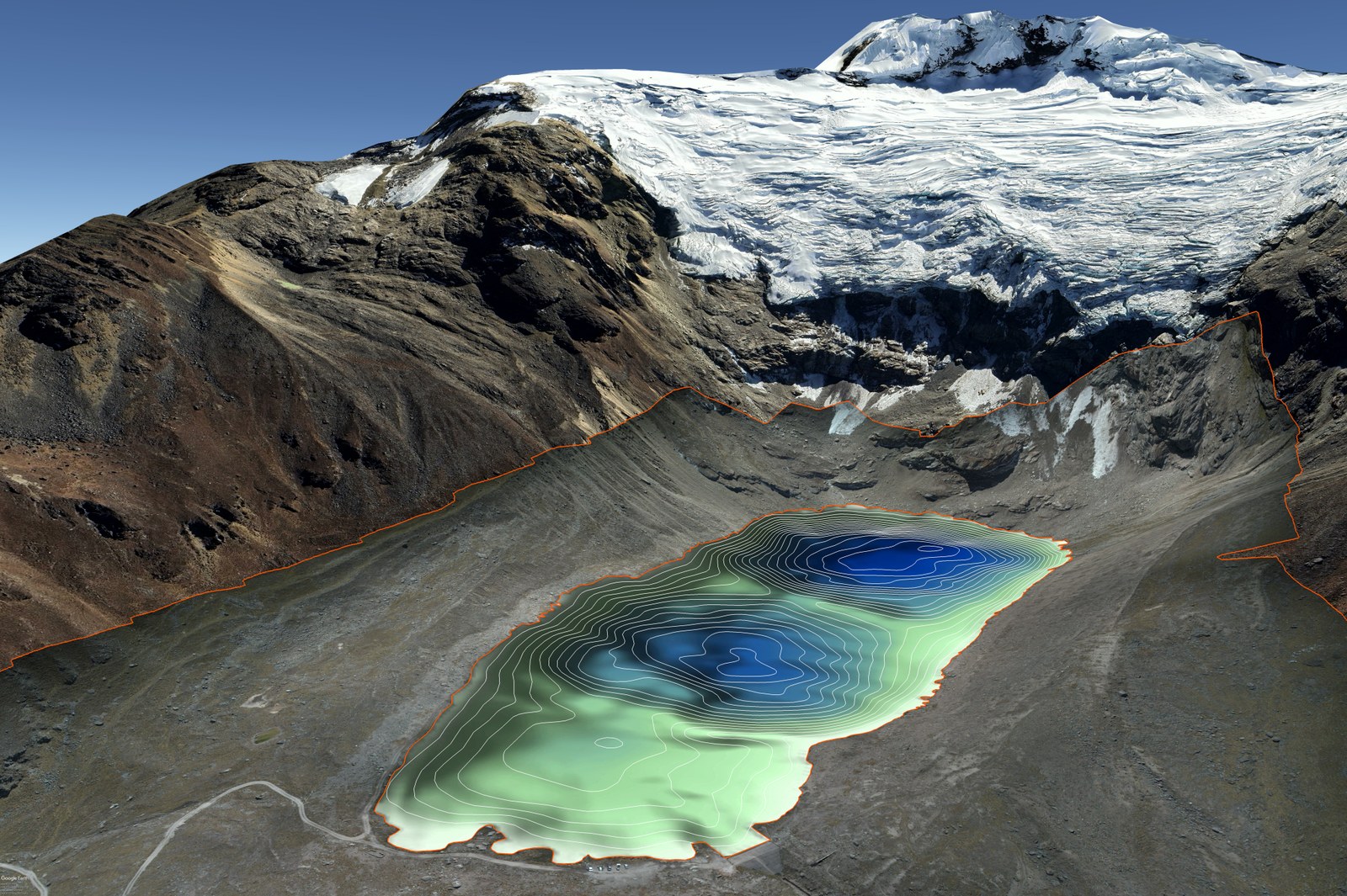
Mosaic image of Lake Lasuntay
A high-resolution and georeferenced mosaic image of the entire lake and its surroundings (orange lines) was created from overlapping drone images. The topography of the lake bed – the bathymetry – was established on the basis of the water depth measurements and is represented by the white contour lines in the lake.
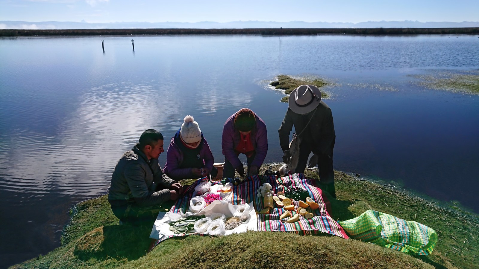
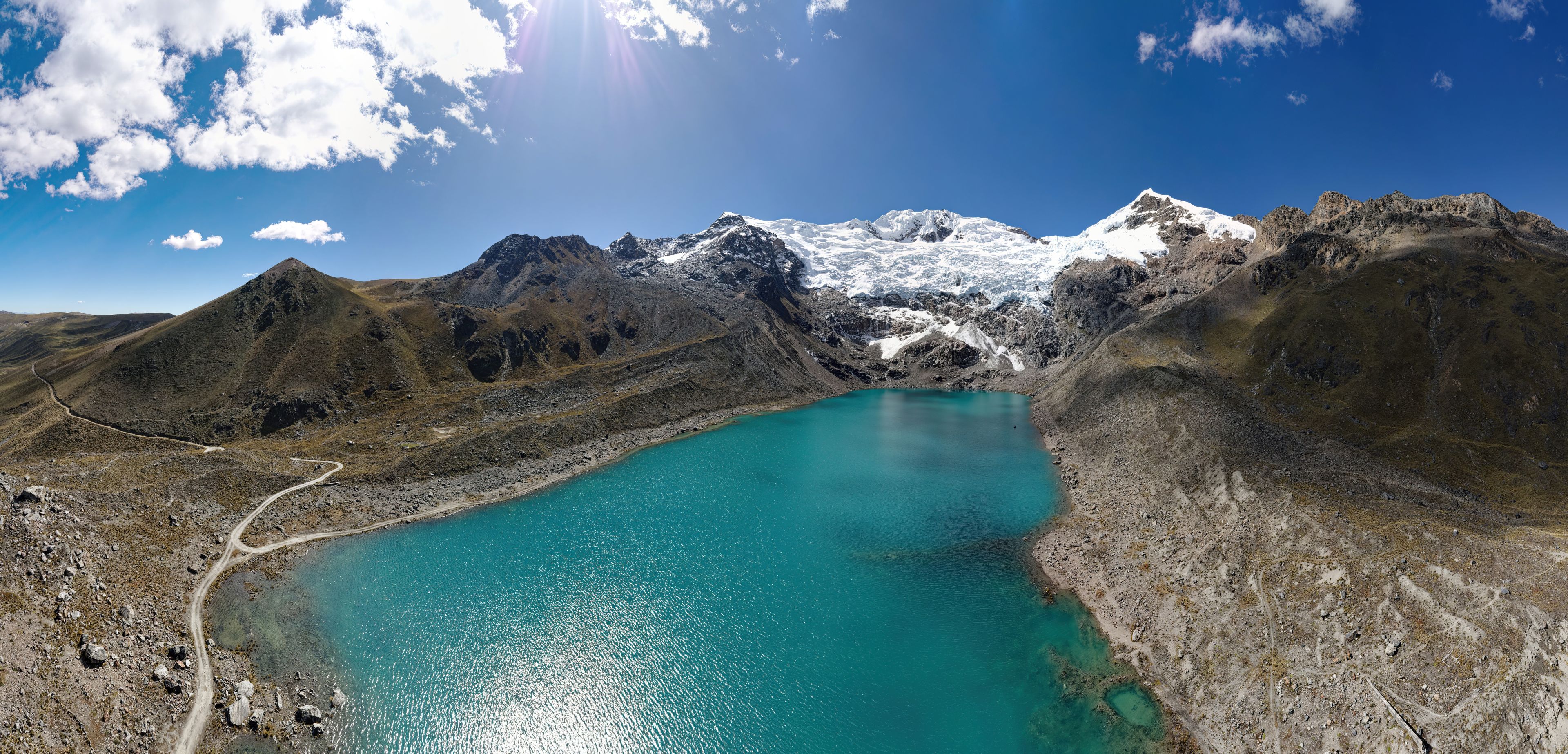
Lying at an altitude of over 4500 metres Lakes Lasuntay and Huacracocha supply drinking water to the 500,000 inhabitants of Huancayo. During the campaign, getting there took approximately two hours by car and involved an ascent of 1300 metres. As the hustle and bustle of city traffic quickly disappeared, so did the tarred surface of the mountain road along the narrow valley of the Río Shullcas. A construction site at the end of this single-track route restricted the dusty journey to the lake and back to just a few narrow time slots each day. After months of preparatory work, countless approvals from various authorities and the active support of the Peruvian project partners, the pickup convoy finally reached the shore of Laguna Lasuntay. At long last, everyone stood before the majestic glacier of the 5557-metre-tall Nevado Huaytapallana. After the traditional 'Pagapu al Agua' offering, the field measurements began – to the sound of sporadic ice avalanches, which occur up to five times a day due to climate change.
Drone image of Lake Junín
The drone images show the diverse composition of the water, subsoil and shores of Lake Junín. This information was used to identify suitable locations for the measurements, which the team could then access by boat.
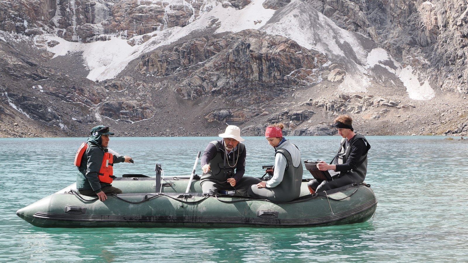
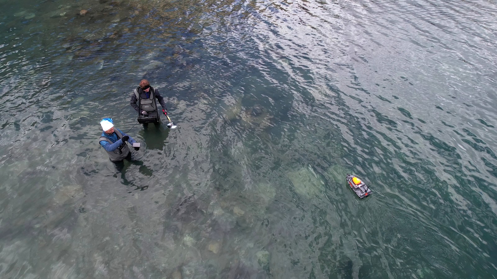
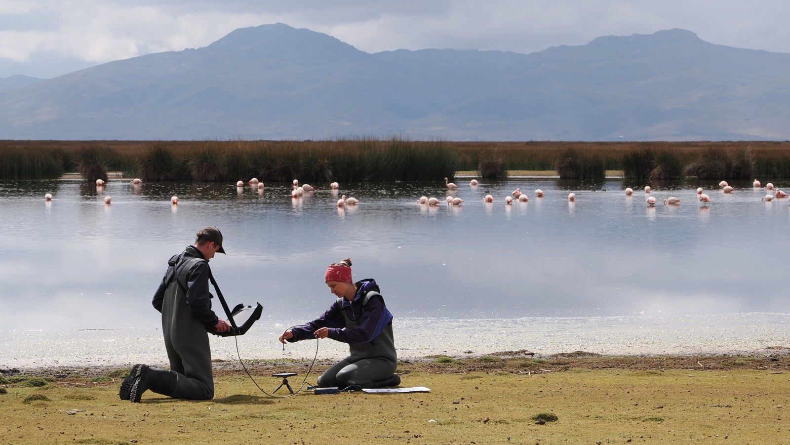
The team recorded reflectance spectra of the water surface of Lasuntay and Huacracocha for several consecutive days, in deep spots from an inflatable boat and in shallower areas by walking into the lake in waders. The researchers used a portable spectrometer – the mainstay of the field measurement campaign. They also collected reflectance spectra from sediments, stones and plants on the lakebed and the shore. At the same time, a small self-developed, autonomous measuring boat travelled transects and recorded the water depth with an echo sounder. From the air, a drone capable of operating at this altitude mapped the lake and its surroundings by taking hundreds of images. The measurement programme also included taking water samples for subsequent analyses in the laboratory.
Satellites will help determine water quality in the future
The concentrations of the water components chlorophyll, suspended solids and coloured dissolved organic matter determine the optical properties of a body of water. The researchers used the reflectance spectra measured on site to determine these concentrations, as well as the dominant phytoplankton group. These parameters serve as indicators of water quality and complete the biochemical water profiles. The ANA generates these once or twice a year using water samples that are analysed in the laboratory. The DLR team adapted its evaluation algorithms to regional conditions based on the measurements. In the future, it will be possible to derive these parameters from satellite images of lakes in the region. The major advantage of this is that it will be possible to use satellite images to make statements about the condition of the lakes without having to carry out measurements on site each time. This will be done more frequently, at lower cost and, above all, not just for a handful of measuring points, but for the entire lake area.
The team concluded its activities in Huancayo with a presentation and discussed their progress and initial findings with the Lima authorities. The complete bathymetric mapping of Laguna Lasuntay – a first – generated particular interest. Not only has this enabled the validation of the water depth derived from satellite images, but it has also made it possible to determine the volume of the lake and thus the availability of the already scarce drinking water for Huancayo, in order to better plan the provision of water to the population
Traversing the second-largest lake in Peru
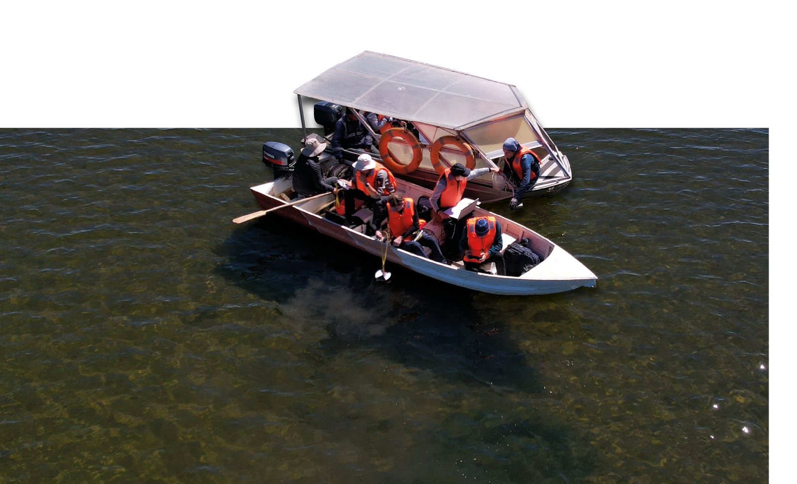
After the first week of the campaign, the journey continued to Lake Junín, or Lago Chinchaycocha, as the local people call it. By then, the DLR team had acclimatised to the altitude, and the five-hour drive across 175 kilometres of mountainous terrain made a welcome change from their rigorously orchestrated measurement schedule. The researchers began their sampling from the small village of San Pedro de Pari, where two boats and experienced guides were available for the project. The local residents also supported the planned measurement activities. This is not the case everywhere in the lake's region due to years of conflict between local communities and the authorities as a result of the actions of the local mining industry, which has been heavily polluting the lake with its wastewater for decades. In addition, the Upamayo dam, built in the 1930s at the source of the Rio Mantaro, raises the water level and repeatedly causes the flat expanses of land beside the lake to flood. As a result, small-scale local livestock farmers have suffered significant losses again and again, while the sensitive ecosystem, a paradise for birds, has also been severely affected.
The team measured the water depth and collected sediment samples from the bottom of the lake.
The samples were later analysed with the spectrometer.
The working day started very early due to the weather. At daybreak, the llamas and alpacas that graze the area were hidden in the foggy, frosty landscape. The second largest lake in Peru lies at 4085 metres above sea level and is about a third the size of Lake Constance, so it can take one to two hours to navigate from the shore to a measuring point. It becomes windy and turbulent in the afternoon, so the team had to leave the water by noon at the latest. To be on the safe side, a second boat was taken along, as it is not uncommon for a boat's propeller to get caught in the shallow lakebed – a mixture of aquatic plants, silt and mud – or for one of the old engines to malfunction.
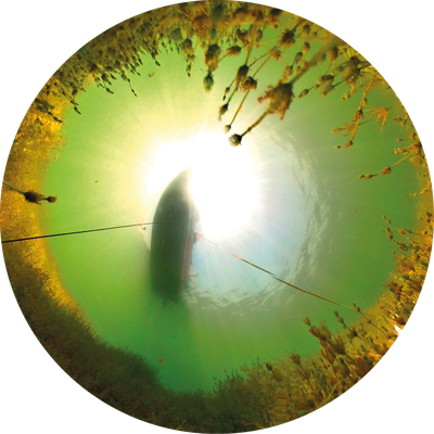
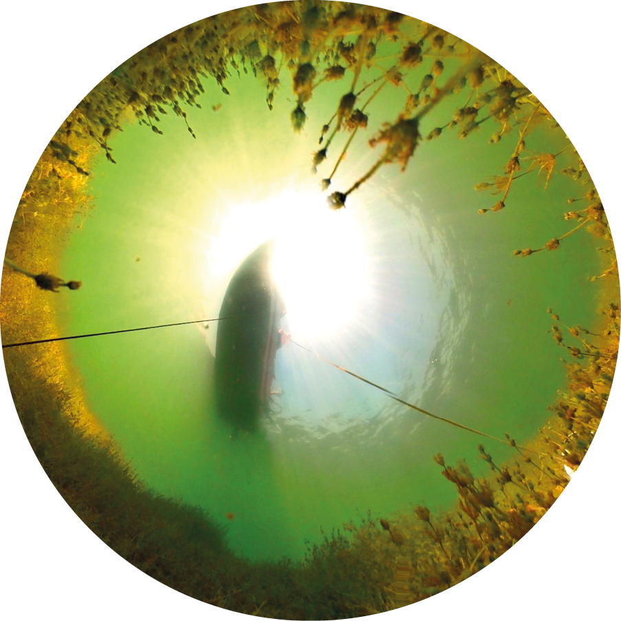
Lake Junín from underneath
An underwater camera documented the subsurface composition of the lake.
Due to the size of this lake, the team's measurement objectives here differed from those at the smaller lakes close to Huancayo. A complete bathymetric mapping with the small measuring boat would be unimaginable. Instead, the team covered representative transects. In the future, the measurement data will be used to create more accurate maps based on satellite data. At the same time, the researchers recorded a wide variety of reflectance spectra with the field spectrometer, not only on the surface in deep and shallow areas of the lake, but also at various points on the lakebed and near the banks. Here, too, the drone proved its worth: its images allowed suitable measuring points to be found much more easily than from a boat. These are areas with macrophyte growth or suspended sediment plumes, for instance. An underwater camera also documented the lakebed for subsequent evaluation of the findings.
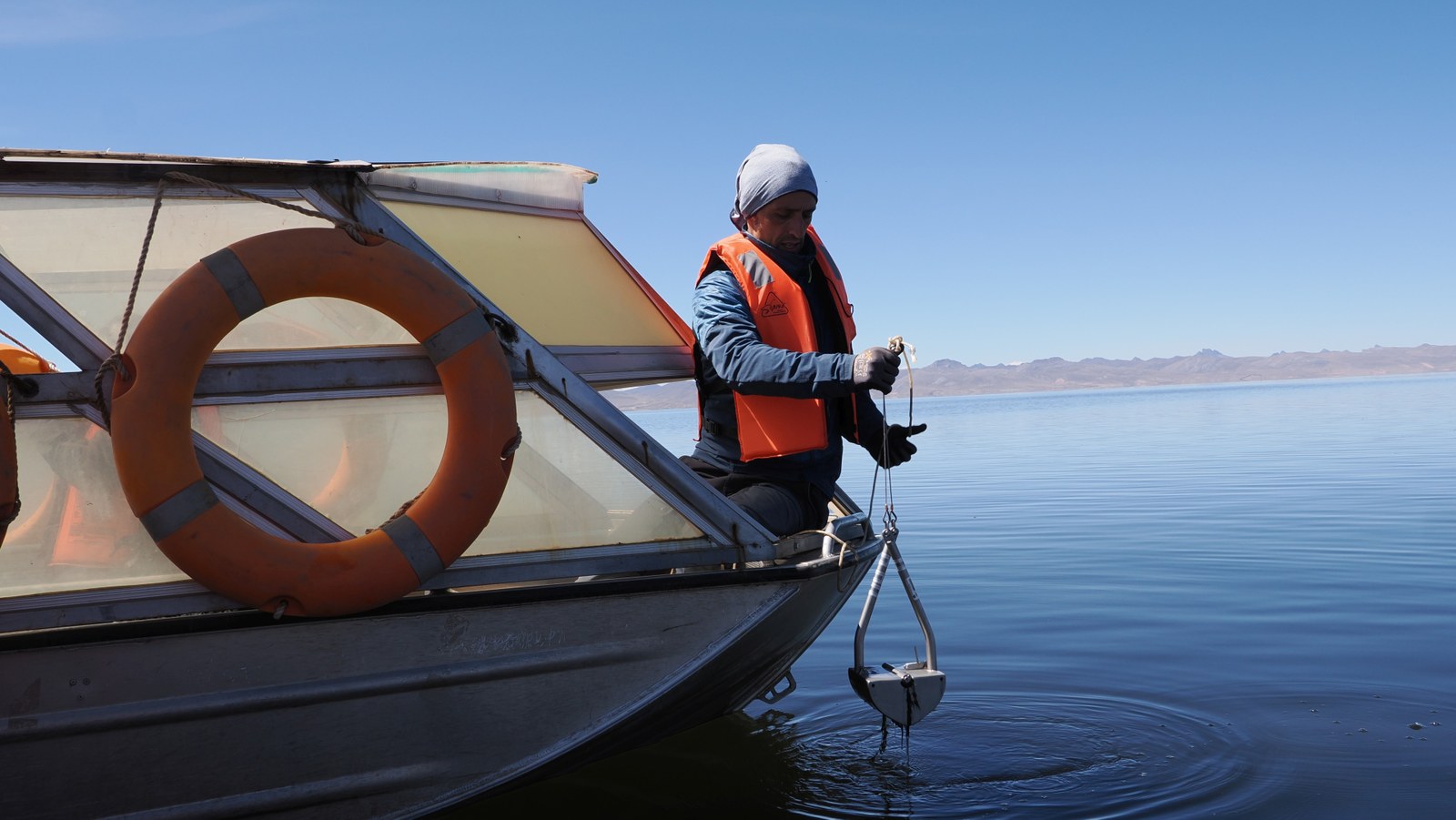
Grabbing data
Ian Somlai Schweiger takes samples from the bottom of Lago Chinchaycocha.
To be able to determine the water parameters as accurately as possible from satellite data at a later time, the on-site measurements ideally needed to be synchronised with overpasses of multi- or hyperspectral satellites like Sentinel-2, Landsat-9 or EnMAP. And the sky had to be cloudless for this to happen, which unfortunately, is not always the case in this area. What is more, on the only day on which these three satellites flew over Lake Junín within an hour, celebrations in honour of the patron saint of San Pedro de Pari were taking place and no boatmen were available. Nevertheless, at the end of the two-week campaign, the team collected a valuable data set: a total of more than 90 reflectance spectra, over 40 water samples, many water depth profiles and countless images and videos from the air and above and under the water, including some satellite images. During the following months, the DLR researchers discussed the results of the data analysis with the ANA and summarised them in a guide. This will enable them to continue using the methods they have learnt and tested independently. And, it goes without saying that the team will treasure their memories of this unique measurement campaign in the South American highlands for a long time to come.
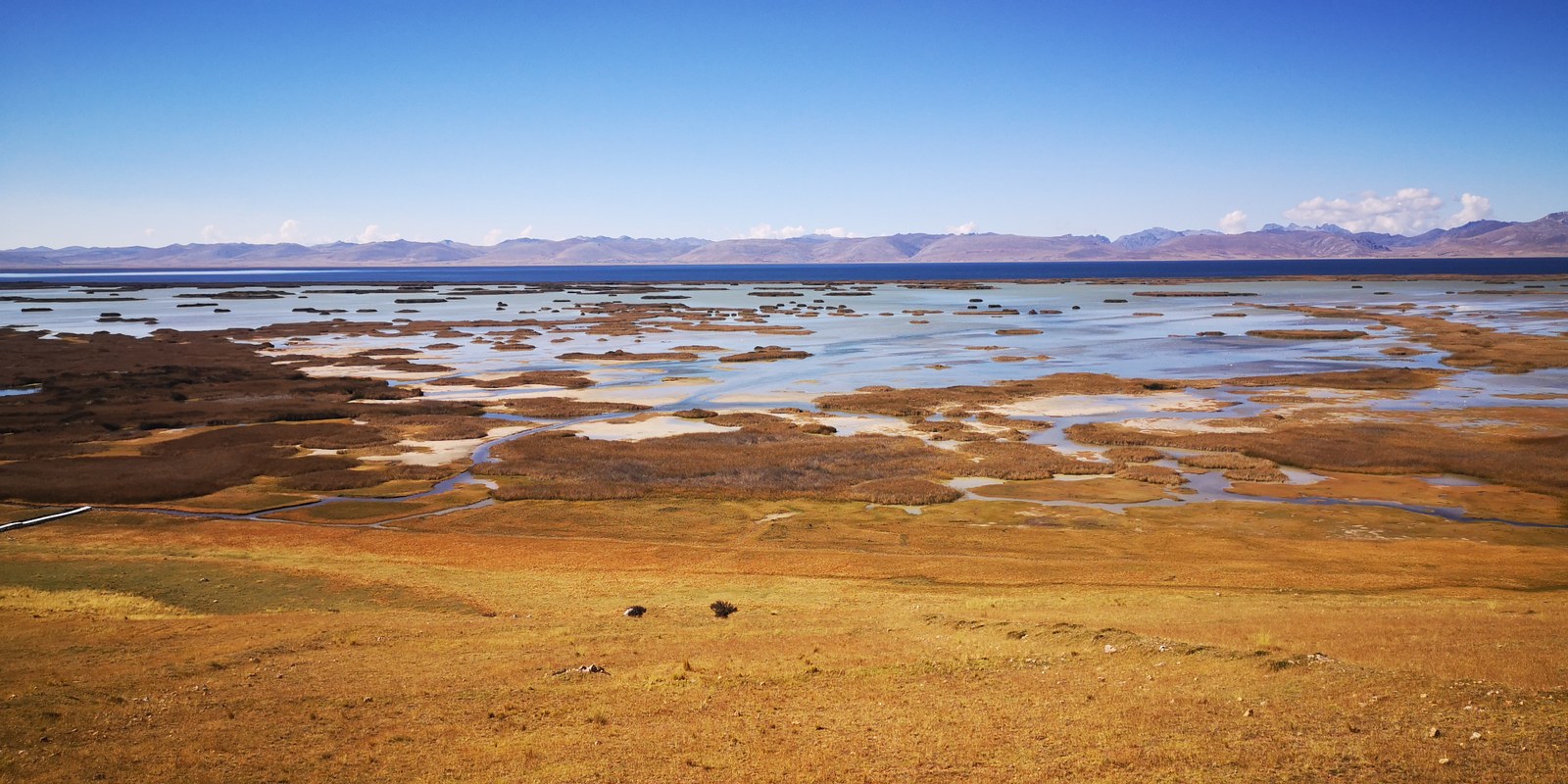
Lake Junín boasts wide shallow water areas.
The areas are bordering the central, deep lake area – an appealing and challenging mix for remote sensing of water bodies.

