
Scientific Areas

TanDEM-X has been designed to provide high quality data for commercial and scientific applications. As far as the scientific applications and corresponding geo-physical products are concerned, they have been endorsed with a questionnaire distributed to a large number of scientists. Many of the scientists represent end-users and have a long experience with the SRTM, SIR-C/X-SAR as well as ERS-1/2 data evaluation.
The scientific applications can be summarized in three groups:
Across-Track Interferometry
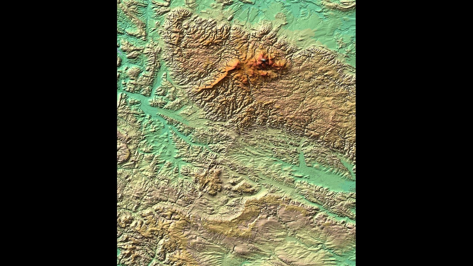
A consistent and reliable DEM data set with global coverage and DTED-3 standard is an important information for a variety of on-going research areas and will allow new scientific applications to be developed. Examples are:
- hydrology (ice and snow, wetlands, morphology and flooding),
- geology (geological mapping, tectonics, volcanoes and land-slides),
- land environment (cartography, urban areas, disaster and crisis management, navigation, archaeology and change detection),
- renewable resources (land use mapping, agriculture, forestry and grassland),
- oceanography (wind and waves, ocean dynamics, sea-ice, ship detection, oil slicks and bathymetry). Some of these applications foresee the combined use of along- and across-track interferometry as well as polarimetry to enhance current products.
Along-Track Interferometry
Along-track interferometry will allow innovative applications to be explored. Along-track interferometry can be performed by the so-called dual-receive antenna mode (ca. 2.4 m along-track baseline) and/or by adjusting the along-track distance between TSX-1 and TanDEM-X to the desired value (up to 4 phase centers). By means of newly developed orbit concepts, the along-track component can be adjusted from 0 to several kilometers. The combination of the two different along-track baselines will be explored for moving target detection (MTI) and traffic monitoring applications. The following sub-groups have been defined for along-track interferometry:
- Oceanography (Ocean currents maps, ocean wave spectra),
- Moving Target Detection (Traffic flow monitoring maps - see also moving target techniques in application area C),
- Glaciology (Ice flow monitoring maps).
New Techniques with Bi-Static SAR
The TanDEM-X mission will provide the remote sensing scientific community with a unique data set to exploit the capability of the new bi-static radar techniques and to apply these innovative techniques for enhanced parameter retrieval:
- Super Resolution (high resolution maps, micro-topography enhancement maps, feature extraction algorithms)
- Bi-static SAR (new bi-static SAR processing algorithm s, multi-angle SAR, enhanced scene feature extraction, combination of mono-static and bi-static signatures),
- Moving Target Detection (detection of ground moving targets and the estimation of their velocity using digital beamforming and STAP techniques with the 2 + 2 phase centers of the TerraSAR-X and TanDEM-X antennas),
- Polarimetric SAR Interferometry (DEM optimization using polarization diversity, vegetation bias and structure maps, crop biomass).