Skip to main content
Skip to navigation
Skip to footer
DLR Portal
Press
Accessibility
de
en
Earth Observation Center
About us
About us
Research & Transfer
Research & Transfer
Latest
Latest
Multimedia
Multimedia
Careers & Education
Careers & Education
>
About us
>
Remote Sensing Technology Institute
>
SAR Signal Processing
>
>
SAR Interferometry
>
ERS data
Home
>
About us
>
Remote Sensing Technology Institute
>
SAR Signal Processing
>
SAR Interferometry
>
ERS data
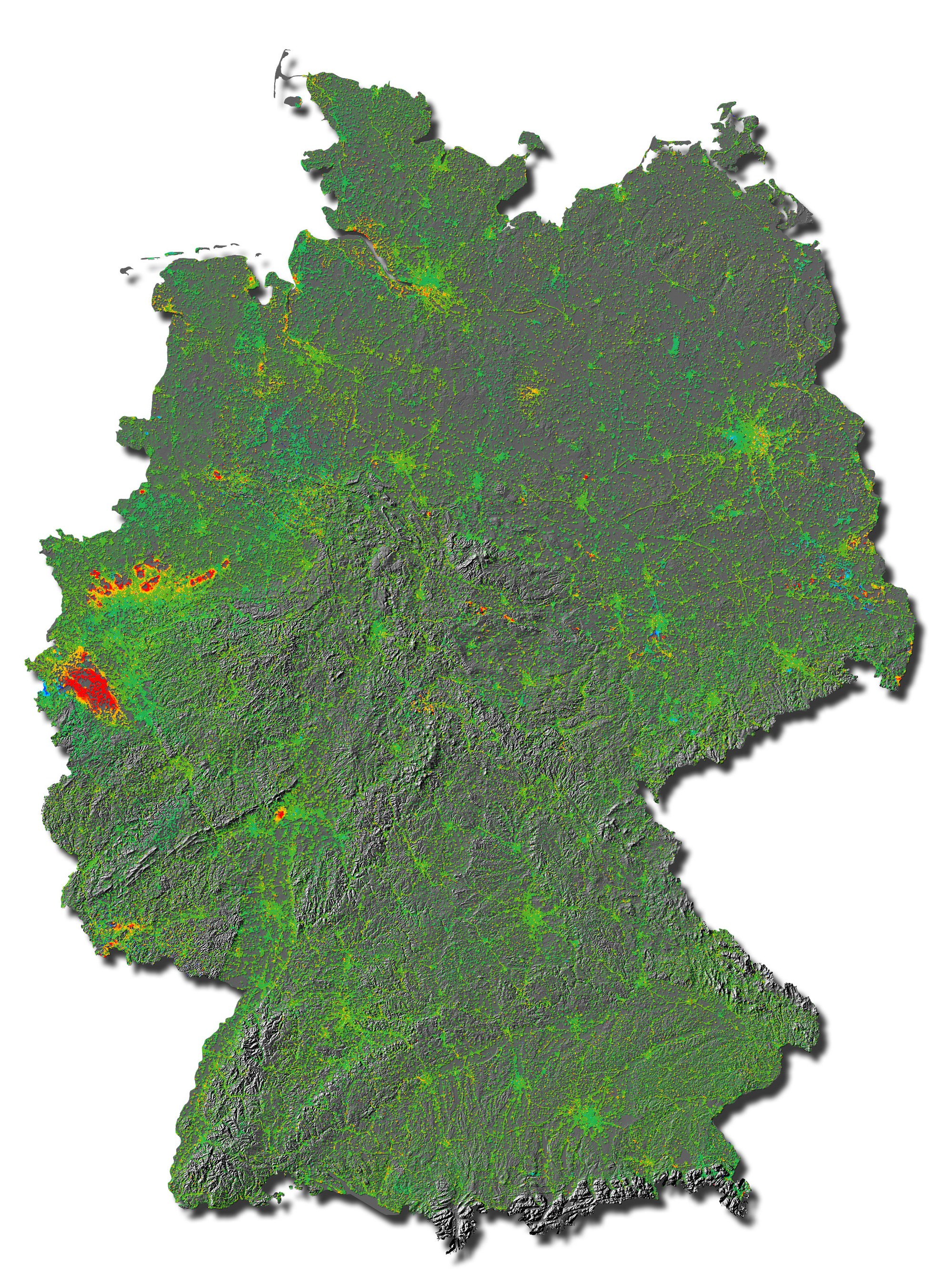
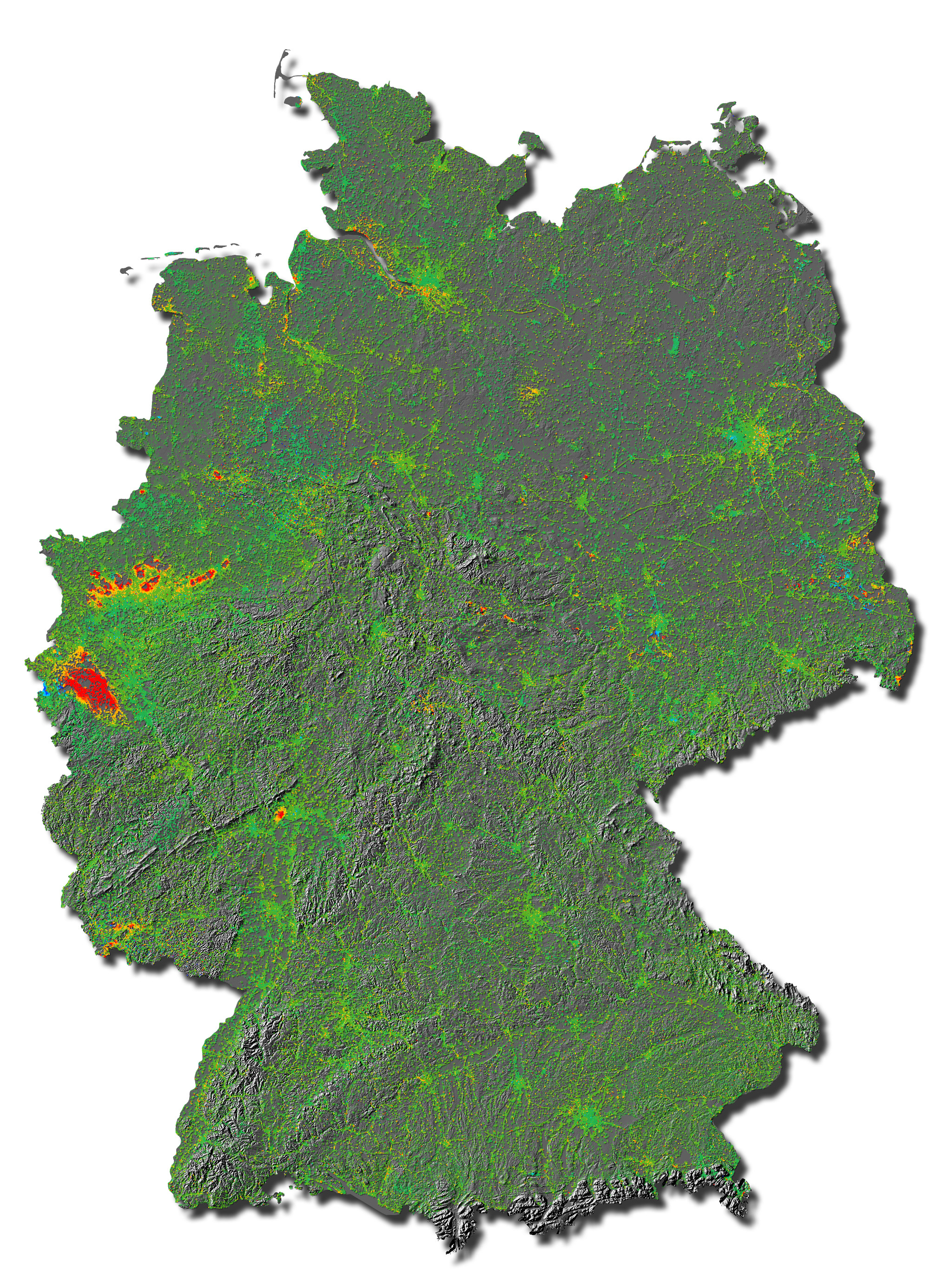
ERS data
ERS data
Ground subsidence (red) and uplift (blue) map of Germany, derived from ERS data.
Credit:
DLR (CC BY-NC-ND 3.0)
Download
Download

